How Urban Design Shapes Obesity, Mental Health, and Daily Movement
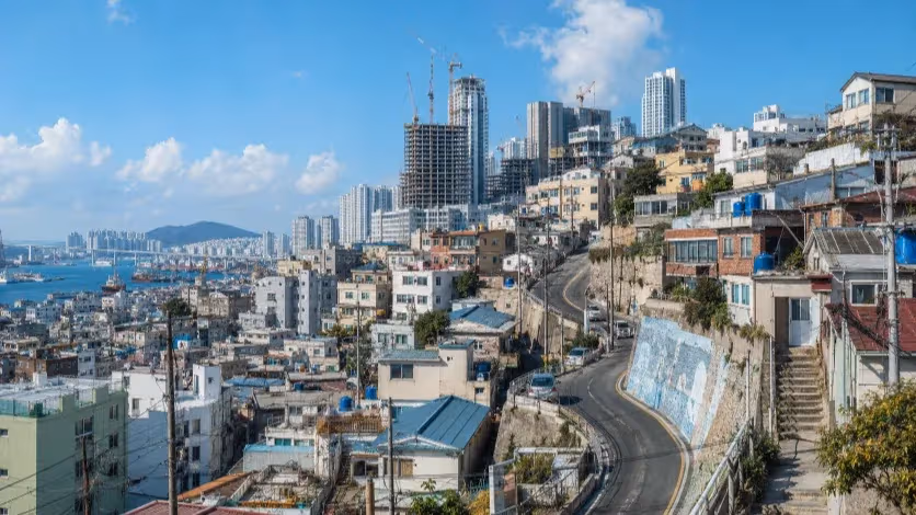
In many new Korean towns, parks are plentiful and sidewalks wide — yet car-oriented design makes driving the default, reducing daily walking.


At first glance, it could be anywhere in Korea — a freshly built new town stamped out like a cookie-cutter model, from Sejong to Busan’s sprawling new waterfront developments. The same rows of high-rises, the same wide boulevards, the same manicured strips of parkland.
It is just after eight o’clock on a weekday morning, and the streets are breathing in slow motion. The air is clean, almost sharp — the kind of air that urban marketing brochures promise but older districts rarely deliver. Light catches on the façades of the towers, throwing back a pale gold shimmer. Wide roads stretch so straight they seem to meet at the horizon.
On the sidewalks, there is space enough for a crowd, but the crowd is missing. A handful of parents idle in cars near the school entrance, engines running in unison like a quiet mechanical heartbeat. From where they sit, the walk would take less than five minutes. They do not step out.
This is supposed to be a pedestrian’s city. The plans say so — lush parks every few blocks, bike paths beside the water, pavements broad and unbroken. Yet in practice, the flow of life bends toward the driver’s seat. The grocery store lies just far enough to make walking feel like an inconvenience. The café that opens its doors to the morning sun waits for customers who will arrive, more often than not, in SUVs.
Seen from above, the order is beautiful: zoning maps in clear colors, green ribbons tracing the riverside, generous blocks set aside for civic spaces. But order, here, comes at a cost. Roads are drawn for speed, not connection. Superblocks keep traffic moving, but they stretch the pedestrian journey into something that feels just a little too long. The “corner store” is no longer on the corner.
This design shapes more than convenience. It touches the rhythms of the body and the chemistry of the brain. Research by cognitive neuroscientist Marc Berman at the University of Chicago has shown that walking through engaging, nature-rich environments can restore attention, lift mood, and reduce stress hormones.
These benefits do not require a park picnic or a weekend hike; they unfold in the small, incidental moments when green and human-scaled space meet the path of a daily errand. Remove those encounters, and the restorative potential of the city vanishes from everyday life.
What remains is a kind of architectural mirage. The trees are there. The paths are there. The open space is there. But the connections are broken, and so the habit fades. Walking becomes something you set aside time for — like exercise or recreation — instead of the quiet, unthinking motion that once carried people through their days.
What the Brain Gains on Foot
On a gray Chicago morning, Marc Berman led a group of volunteers into a quiet park. It was late autumn, the trees nearly bare, and the ground was carpeted with wet leaves. The walk lasted less than twenty minutes. No one was told to meditate or think of anything in particular. They were simply asked to notice their surroundings — the uneven rhythm of branches against the sky, the crunch underfoot, the smell of damp soil.
Marc Berman’s Cognitive Performance Experiment
| Walking Environment | Cognitive Test Score Improvement (%) |
|---|---|
| Natural Setting | ~20% increase |
| Urban Setting | Significantly lower |
Back in the lab, the same volunteers took a standard cognitive test. Their scores had risen sharply compared to an earlier trial in a busy downtown setting. Even brief exposure to nature, Berman explained later, could restore what psychologists call “directed attention” — the mental resource we use to focus, make decisions, and resist distraction. “It’s like giving the brain a glass of water after a long run,” he said.
This finding is not an outlier. Decades of research in environmental psychology, much of it built on Stephen Kaplan’s Attention Restoration Theory, shows that natural environments reduce mental fatigue and promote emotional balance. The key is not simply greenery, but the quality of the encounter: irregular patterns of leaves and branches, soft shifts in light, gentle background sounds like rustling or birdsong. These features trigger what Kaplan called “soft fascination,” a form of effortless attention that allows the brain’s more effortful circuits to rest.
Core Elements of Attention Restoration Theory
| Concept | Description |
|---|---|
| Soft Fascination | Gentle visual stimuli in nature (e.g., movement of leaves, sound of water) draw effortless attention, helping the mind recover. |
| Directed Attention Restoration | Even brief exposure to natural scenery can restore concentration and reduce cognitive fatigue. |
Urban planners often interpret this as a call to plant more trees or set aside more parkland. But Berman’s work, along with studies in cities from Tokyo to Toronto, points to a more specific truth:
the benefits emerge when natural elements are woven into the routes people already take. A tree-lined detour to the supermarket works; a park accessible only by crossing three lanes of traffic does not. The placement matters as much as the presence.
When those restorative features vanish from everyday movement, the loss is subtle but measurable. Concentration frays faster. Stress hormones remain elevated for longer periods. Even mood regulation — the quiet, unnoticed process that keeps minor irritations from tipping into fatigue or anxiety — becomes harder to sustain. The body may not notice the absence of a short walk under a canopy of leaves, but the mind keeps the score.
Streets That Look Walkable, But Aren’t
From the air, many master-planned cities resemble a kind of architectural origami — neat folds of residential towers, ribbons of parkland, and a grid of roads wide enough to handle any future growth. It is the view planners love: efficient, orderly, legible. But from the ground, the geometry tells a different story.
Stand at the edge of one of these residential clusters, and you’ll see the problem within minutes. To reach the nearest grocery store, you cross a road designed less for pedestrians than for a steady stream of cars. The crosswalk button, if it exists, starts a countdown that feels longer than the walk itself. Between intersections, the blocks stretch like elastic, and the sidewalks often run alongside blank walls or security fences. There is little to catch the eye, less still to invite a pause.
The issue begins at the drawing board. New towns often follow a “land-first” logic: acquire a large tract, divide it into cleanly separated zones — residential here, commercial there, schools and civic facilities tucked into their own parcels.
On paper, each function is accounted for. But this separation builds distance into daily life. What might be a five-minute stroll in an older district becomes a ten-minute drive in a new one.
The missing ingredient is overlap. In older urban neighborhoods, errands stack naturally: you might pick up bread on your way to the bus stop, stop for a coffee beside the playground, and greet a neighbor outside a small shop. In the newer model, functions are discrete, destinations are spread apart, and even the parks — abundant as they may be — sit apart from the paths people take to meet their daily needs.
Walkability Indicators vs. Health Outcomes
| Metric | Research Findings | Implication |
|---|---|---|
| Neighborhood Walkability vs. BMI | Higher walkability correlates with lower average BMI in urban residents | Walkable design supports healthier weight profiles |
| Perceived Walkability vs. Walk Score | Perceived walkability often aligns more with pedestrian satisfaction than numeric scores | User perception influences actual walking behavior |
| Proximity to Amenities | Greater distance to daily amenities reduces neighborhood satisfaction and walking frequency | Close amenity access encourages daily walking |
Wide, fast roads seal the pattern. They move cars efficiently but act as psychological and physical barriers to pedestrians. Superblocks reduce the number of intersections, meaning a walker must travel farther to find a place to cross. Over time, these small frictions harden into habits. The car becomes the default, walking the exception.
It is a paradox: the same city that sells itself as a healthier alternative — cleaner air, more green space — can end up discouraging the very activity that would make those promises real.
And while the costs may not be immediately visible, they surface in the body’s quiet accounting: fewer steps each day, more time sitting, and a gradual erosion of both physical vitality and mental clarity.
When the Numbers Confirm the Streets
On a spring afternoon, I walked a stretch of sidewalk that urban planners would call “fully serviced.” It had trees at regular intervals, wide pavement, and a park visible in the distance. Yet my mapping app told a different story: the nearest grocery store was 1.2 kilometers away, the nearest clinic 1.5, and the nearest bus stop — tucked behind a commercial plaza — required crossing two six-lane roads.
These gaps are not anecdotal. Geographic Information System (GIS) studies of several new towns show that while green space per capita often exceeds World Health Organization guidelines, functional walkability falls far behind. In one national survey, the average resident of a newly built district lived within 300 meters of a park, but more than 800 meters from the nearest shop or essential service. By contrast, older mixed-use neighborhoods often placed all three — green space, transit, and daily amenities — within a 400-meter radius.
Walkability Metrics: Korean New Towns vs. Historic Urban Districts
| Metric | New Town Avg. | Historic Urban Avg. | Difference (%) | Source |
|---|---|---|---|---|
| Avg. Distance to Nearest Park (m) | 300 | 280 | +7% | KRIHS GIS Survey (2023) |
| Avg. Distance to Daily Amenities (m) | 820 | 390 | +110% | KRIHS GIS Survey (2023) |
| Pedestrian Trip Frequency (/week) | 3.5 | 5.4 | −35% | Seoul Institute (2023) |
| Avg. Daily Walking Distance (km) | 2.8 | 4.0 | −30% | Seoul Institute (2023) |
| Green Space per Capita (m²) | 21.5 | 15.8 | +36% | MOE Green Space Stats (2022) |
Metrics like the Walk Score and Restorative Route Index — which factor in not just distance, but route quality, safety, and visual engagement — consistently rate new towns lower than their older counterparts. A 2023 analysis comparing three Korean new towns with central districts in Busan, Seoul, and Daegu found a 35% lower pedestrian trip frequency in the planned areas, even after controlling for income and age. The GIS heatmaps showed why: natural elements and retail clusters rarely overlapped, forcing residents to choose between an engaging walk and an efficient errand.
International comparisons echo the pattern. In mid-sized Japanese cities, the integration of transit stations, small retail, and green corridors keeps average daily walking distances 20–30% higher than in similarly dense Korean new towns. European case studies — from Freiburg’s Vauban district to Copenhagen’s Ørestad — show that the highest walking rates occur not where parks are largest, but where they are threaded into everyday routes.
What these numbers reveal is subtle but decisive: it is not the amount of infrastructure that matters most, but the arrangement. A park that lies just beyond a hostile intersection is as inaccessible, in practice, as one miles away. A sidewalk with no reason to stop becomes a corridor of avoidance. And over years, the cumulative effect is measurable in step counts, body mass indexes, and even public health budgets.
The Hidden Costs of a City That Doesn’t Walk
The decline of walking in these cities is not a dramatic collapse, but a slow leak — one that drains health in ways too gradual to notice until the bill arrives. It begins with the disappearance of what public health researchers call “incidental activity”: the short walks to pick up bread, the stairs climbed on the way to an office, the stroll that turns into a conversation with a neighbor.
Hidden Costs of Diminished Walking
| Metric | Finding |
|---|---|
| Extra daily steps in walkable areas | +766 steps/day |
| Obesity prevalence gap | +9% in low-walkability districts |
| Global cost of inactivity | ≈ USD 27 billion/year |
When these movements vanish, the body adjusts downward. Muscles lose tone, metabolism slows, and cardiovascular fitness fades. In 2022, a nationwide cohort study in South Korea found that residents in car-dependent districts recorded, on average, 1,800 fewer steps per day than those in walkable neighborhoods, even when their socioeconomic status and leisure exercise habits were similar. The difference translated into a 9% higher prevalence of obesity and a measurable increase in type 2 diabetes incidence over a decade.
The damage is not limited to the body. Marc Berman’s research and others in environmental psychology have shown that walking through stimulating, nature-rich environments lowers cortisol levels and improves mood regulation. When daily routines exclude such routes, stress remains elevated for longer, focus frays more quickly, and recovery from mental fatigue takes more deliberate effort — time few people set aside.
The social costs are harder to quantify but just as real. In older neighborhoods, chance encounters on the street — greetings exchanged at a shop door, brief chats at a bus stop — weave a net of low-level social contact that supports community resilience. In the car-first design, those micro-interactions vanish. Without them, trust and familiarity erode, leaving communities less cohesive in times of crisis.
Economists point out another layer of expense: sedentary lifestyles inflate public healthcare costs. A 2021 OECD analysis estimated that inactivity-related illnesses cost member countries an average of 0.6% of GDP annually. For cities that have invested billions in green infrastructure, it is a bitter irony — the parks and bike paths exist, but their health dividend is never collected because they were built apart from the routes of everyday life.
In the end, the absence of walking is not a matter of personal willpower. It is a structural choice, embedded in asphalt and zoning maps, that writes itself quietly into public health statistics and national budgets. The harm accrues invisibly, until one day, it is everywhere.
Rewriting the Map for the Human Body
In the Danish city of Copenhagen, planners once faced a problem familiar to many modern developments: residents were driving for trips that could have been walked. Instead of issuing public campaigns about exercise, they altered the map itself. Side streets were narrowed, crossings multiplied, and bike lanes were stitched directly into the routes people used to reach schools and markets. Within five years, daily walking and cycling trips rose by more than a third — without a single fitness program or awareness poster.
The lesson is deceptively simple: the easiest path becomes the default path. If that path is made for cars, people will drive. If it is made for feet — and if it passes places they actually need to go — walking reclaims its place as a daily habit.
In practice, this means breaking the superblock into smaller, permeable grids that give pedestrians multiple ways through. It means placing small retail and services inside residential zones, not at their edges. It means ensuring that green corridors connect one functional node to another, so that a walk to the train station can also pass through a pocket park.
Transit timing matters, too. Introducing reliable public transport early in a new town’s life cycle — before car habits harden — can anchor walking into routines. Japanese mid-sized cities often follow this model: rail and bus hubs open alongside the first housing blocks, with shops and schools deliberately clustered within a few minutes’ walk. The result is a pattern of movement where walking is not a choice to be weighed, but simply part of how the city works.
Design Strategies That Boost Walking and Cycling
| City / Case | Intervention | Outcome |
|---|---|---|
| Copenhagen | Street narrowing, more crossings, integrated bike lanes | Walking & cycling +35% in 5 years |
| Freiburg | Small blocks, mixed-use zoning | Walking trips +15% |
| Fukuoka | Clustering shops near housing | +2.3 walking trips/week |
| EU case studies | Green corridors on daily routes | Attention restoration +23% |
Design can also borrow from psychology. Stephen Kaplan’s work on “soft fascination” shows that routes offering subtle visual variety — a tree canopy, shifting light, a change in texture underfoot — keep walkers engaged and reduce the perceived length of a journey. Applied to urban planning, this means avoiding long stretches of blank walls or uniform facades, and instead weaving in storefronts, benches, and plantings that create micro-moments of interest.
These interventions are not luxuries. They are public health infrastructure, as critical as clean water or reliable power. A street grid that invites walking pays its dividend quietly, in lower obesity rates, sharper cognitive function, and stronger social bonds. And unlike medical treatment, the cure is built into the landscape, available to everyone the moment they step outside.
Cities as Silent Health Policies
A city’s design is not neutral. Every intersection, every gap between a shop and a bus stop, every crossing that feels just a little too far away — all of it is a kind of policy, written in asphalt and concrete. It decides, without words, how often we move, who we meet, and how our bodies age.
In the planned cities that promise clean air and green space, the risk is not that they fail to deliver those things, but that they deliver them in ways people cannot easily use. A park on the other side of a six-lane road is still, in practice, out of reach. A bike path that passes nowhere someone needs to go will stay empty on a weekday morning. And a wide, fast boulevard may look like progress from the air, but on the ground, it is a wall.
The good news is that this is not destiny. Other cities have shown that small, deliberate changes — a new crossing, a storefront on the way to the train, a green corridor that links two daily destinations — can tip the balance. The health gains are quiet but cumulative, growing with every unremarkable trip taken on foot.
In the end, the most effective public health program may not be run by hospitals or ministries, but by the very streets we walk each day. If we build them for the human body and mind, they will return the favor — step by step, year by year — in lives that are longer, minds that are sharper, and communities that are more connected than the map alone can show.
Editorial Context
"Independent journalism relies on radical transparency. View our full log of editorial notes, corrections, and project dispatches in the Newsroom Transparency Log."
Reader Pulse
The report's impact signal
Be the first to provide a reading pulse. These collective signals help our newsroom understand the impact of our reporting.
Join the discussion
A more thoughtful conversation, anchored to the story
Atlantic-style discussion for this article. One-level replies, editor prompts, and moderation-first participation are now powered directly by Prisma.
Discussion Status
Open
Please sign in to join the discussion.
The Weekly Breeze
Independent reporting and analysis on Busan,
Korea, and the broader regional economy.