South Korea’s Smart Cities and the K-AI City Planning Challenge
South Korea has spent more than two decades building smart cities around digital infrastructure, public transport, environmental systems and urban data. As the country enters the K-AI City era, Songdo, Sejong and western Busan show why the hardest urban problems begin where project boundaries end.

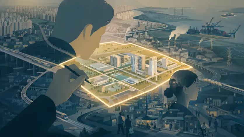
South Korea has spent more than two decades building cities around digital networks, public transport, environmental systems and urban data. As the country enters the K-AI City era, its earlier experiments point to a problem that technology alone cannot solve: the territory of a development project is rarely the same as the geography of the city people actually use.
South Korea is preparing another generation of smart cities. In June 2026, Wonju and the Cheonan–Asan area were selected for the country’s first K-AI City programme, opening a new phase in a policy lineage that has moved from U-City infrastructure and Songdo’s internationally branded experiment to Sejong’s transit-centred administrative city and the national smart-city pilot now taking shape inside Busan Eco Delta City. The technological ambitions have expanded considerably over those two decades, from broadband networks and integrated control centres to autonomous mobility, digital twins, distributed-energy systems and artificial intelligence capable of learning from urban infrastructure and service data. The geography of planning has proved harder to change.
A company in Songdo recruits from a labour market that extends far beyond the international business district. A household in Sejong can live close to one of Korea’s strongest BRT corridors while combining work, school, private education, shopping and medical trips across destinations that do not fit neatly onto a single transit spine. In western Busan, the smart-city pilot occupies only one part of Eco Delta City, which itself forms part of a much wider corridor connecting Myeongji, industrial estates, logistics facilities, Hadan, Gimhae, the port economy and the future airport axis. These places were created for different national purposes and through different institutional arrangements, yet each has revealed the same practical difficulty: planners need boundaries to acquire land, finance infrastructure and assign responsibility, while the urban systems created by those projects immediately begin to exceed them.
Korean planning has long been highly effective at producing bounded projects. Public agencies can assemble land, provide infrastructure and deliver housing at a speed and scale that became central to the country’s urbanisation, while later generations of policy added environmental technologies, public transport, data infrastructure and new urban services to that development capacity. The weakness appears when a boundary created to deliver a project becomes the principal boundary used to understand the city. Workers cross it, housing markets cross it, hospitals draw patients from beyond it and industrial supply chains ignore it; rivers follow watersheds, while traffic generated by one development becomes congestion somewhere else. A smart platform can provide an extraordinarily detailed view of activity inside its territory and still fail to understand the system that produced that activity.
The same problem appears in the way urban value is discussed. A future railway, a hospital agreement, an airport connection, a retail complex or a tourism attraction can enter the economic story of a new district years before it becomes part of ordinary urban life. In western Busan, a private developer has proposed a 1.5 trillion won artificial surfing complex combining surf pools, a rafting facility, hotel, retail space and a performance venue inside Eco Delta City. The proposal may ultimately prove viable, but its significance for urban planning lies in the context around it: another large project has entered a landscape where housing, transport, industry and public services are already being developed through separate plans, jurisdictions and investment cycles.
Project-level success says little about whether the surrounding urban system has become more coherent. A tram may improve one corridor without making dispersed daily destinations easier to reach; an industrial cluster can expand employment without creating a practical relationship between nearby housing, worker skills and shift-hour transport; a major attraction can draw visitors without sustaining the commercial streets surrounding it. Land value can rise in anticipation of infrastructure while accessibility remains untested. The central question for Korea’s next generation of smart cities is therefore no longer whether they can install more technology than the new towns that came before them, but whether the country can plan at the scale of the relationships that technology is supposed to improve.
Three Cities Built for Different Jobs
Songdo, Sejong and Busan Eco Delta City are frequently placed in the same history of Korean smart-city development, although they did not begin with the same assignment. Songdo formed part of a national and metropolitan economic-development strategy centred on the Incheon Free Economic Zone, designated in 2003 as Korea sought to attract international business, logistics and investment. Sejong emerged from the political struggle over the concentration of national government functions in Seoul and became the centrepiece of an administrative relocation and territorial-balancing policy. Eco Delta City followed a different path again: the wider waterfront development was already under way when part of the site was selected in January 2018 for one of Korea’s national smart-city pilot projects.
Their differences matter. Songdo was expected to attract capital, firms and international institutions while creating a new economic centre on reclaimed land. Sejong had to receive a concentration of government employment and build an administrative city around it. Eco Delta City combined large-scale housing and urban development with water management, environmental systems and an experimental platform for new technologies and business models. Comparing them only by the number of smart services deployed would erase the very different state projects from which they grew.
Each project nevertheless began with a territory that could be mapped and governed: a free economic zone and its component development areas, an administrative-city construction area divided into living zones, and a smart-city pilot contained within a larger waterfront development. Those boundaries were indispensable to delivery, yet the economies and daily lives that emerged around them were less obedient. Songdo’s firms recruit from a metropolitan labour market, Sejong’s residents form transport and service relationships with surrounding cities, and Eco Delta City depends on jobs, institutions and mobility networks distributed across western Busan and beyond.
The resulting problem is subtle. Planning boundaries are not mistakes merely because urban life crosses them; public authorities cannot approve budgets or assign responsibility to an undefined region. The weakness begins when the boundary needed to build a project is also assumed to be the right territory for measuring employment access, service provision, housing demand or environmental performance. Smart-city technology can make the problem harder to notice because an instrumented district produces increasingly precise information about itself. Precision inside the boundary can be mistaken for understanding of the city beyond it.
Songdo provides the longest record of what happens after such a project begins to outgrow its original story.
Songdo: The City That Outgrew Its Smart-City Story
Few cities have been described through technology as persistently as Songdo. International coverage for years focused on sensors, broadband networks, automated waste collection and Cisco’s vision of connected urban life, creating the impression that the city had been conceived and delivered primarily by technology companies. Those technologies and companies were real, but a recent political-economic study of the project reconstructs a more conventional and more revealing division of power: Songdo International Business District had emerged from a long public and private development process before the smart-city label became its global identity, while governments, property developers and several technology firms occupied very different positions in the project.
Gale International and POSCO established NSIC in 2002, while Incheon and the national government shaped the wider development through the free economic zone framework. Over time, Songdo carried several overlapping identities—international business hub, new town, free economic zone, eco-city, U-City and smart city—and those labels did not all have the same effect on its physical development. Some altered infrastructure and services; others were more powerful as ways of describing and marketing the project. The 2024 study found that NSIC selected LG CNS as a major domestic technology partner and that Songdo U-Life oversaw the U-City component, while Cisco arrived later and became far more prominent in the international narrative than its financial role in the overall development would suggest.
The importance of that history is not a retrospective argument over corporate credit. It identifies who possesses the durable power to build a greenfield city. Technology firms can design systems, install infrastructure and sell services, but public authorities control planning powers and major infrastructure decisions, while developers control project finance, construction sequencing and cost. When a proposed technology increases construction cost without producing a convincing long-term revenue model, it is the development coalition rather than the technology company that decides whether the service survives.
Songdo also revealed a mismatch between technological and urban time. Large development projects can take decades to mature, while platforms, devices and business models are replaced much faster. The UCL-backed research notes that several services imagined during Songdo’s early smart-city period were later reduced or overtaken by technologies, including smartphones and nationwide digital services, that did not require residence inside a specially equipped district. The planning implication is not that urban technology is pointless, but that a city cannot tie its long-term functioning to a technology generation whose commercial life may end before the district is complete.
Songdo’s longer record is therefore more interesting than the survival of any particular platform. Its most durable economic concentration has emerged in biotechnology, while universities, research programmes and international institutions have accumulated through processes extending far beyond a conventional technology contract. These capacities required land, industrial policy and infrastructure, but they also depended on specialised labour, suppliers, training, institutional recruitment and relationships that could not be fully specified in the original master plan.
The geography of that economy already reaches beyond the district that carried the smart-city brand. Production may be concentrated in Songdo, but workers, suppliers, universities, logistics systems, airports and research relationships form a much wider network. The lesson is not that the original development boundary became irrelevant; rather, the systems that now determine the cluster’s competitiveness operate across a larger territory than the project through which the first investments were organised.
Songdo’s record does not support a simple reversal of the old story in which technology failed and conventional property development succeeded. Real-estate development created vulnerabilities of its own, including exposure to market cycles, phased construction and the difficulty of creating a business centre before all of its metropolitan connections had matured. The district’s long-running interest in stronger regional transport access is itself evidence that a globally marketed business district cannot be understood independently of the labour and housing markets surrounding it.
After more than two decades, Songdo offers a more useful conclusion than either the early futuristic narrative or the later ghost-city caricature. Some technologies became ordinary, some service concepts weakened and some infrastructure remained useful, while the strongest capacities accumulated through industrial investment, universities, research and institutions whose value grew over time. Those outcomes were shaped by planning, but they were not installed as a finished system. They emerged through relationships extending beyond the original development story.
For Korea’s next smart cities, the practical lesson is demanding. The technology layer has to remain replaceable, the city must be able to absorb industries and institutions that were not anticipated at the beginning, and economic planning must follow labour, suppliers, research and transport relationships when those networks exceed the project boundary. Sejong presents a different test because its challenge was never the absence of a strong public plan.
Sejong: Integration on the Plan, Fragmentation in the Rules
Sejong is the most difficult of the three cities to fit into a simple critique of Korean new-town planning. Public transport was not added only after residential growth had established its travel patterns, and the city was not planned as an ordinary commuter suburb with technology added later. BRT, distributed public facilities and a hierarchy of living zones formed part of the city’s structure from an early stage, giving Sejong a degree of integration that many previous new towns lacked.
That makes the city useful precisely because its difficulties cannot be dismissed as the predictable result of forgetting transit, public space or neighbourhood services. The more interesting evidence appears between the master plan and the street, where separate rules governing land use, building scale, streetscape, transport operations and public facilities begin to shape the city through thousands of individual decisions.
A 2023 study of Sejong’s streetscape examined areas governed by relatively recent guidelines intended to improve visual variety and walkability. The researchers identified three mechanisms through which monotonous urban form could still emerge: zoning rules permitting large buildings could overwhelm attempts to create finer variation, standards for consistent street walls could reduce spatial diversity, and design requirements repeatedly applied to individual buildings could produce similar architectural responses despite an explicit aim of variety.
The study matters because it demonstrates how an urban objective can be weakened without any institution formally abandoning it. Zoning, building regulations and design guidelines can each be defensible in isolation, while their combined effect produces a street less varied and less engaging than the planning language intended. The gap lies not between planning and the absence of planning, but between objectives established at one level and incentives operating at another.
Urban integration often breaks down in that space. Transport planners work with routes, frequency and interchange; land-use planners allocate development capacity and uses; architectural rules govern setbacks, façades and form; developers respond to parcel economics, construction finance and market demand; schools and welfare facilities move through separate public budgets. A master plan can place these functions on a single drawing, but the drawing itself does not give them a common decision rule.
Sejong’s BRT system illustrates both the achievement and the limit. The city possesses a strong, legible transit spine conceived as part of the urban structure rather than appended after residential growth. Yet a 2023 Daejeon Sejong Research Institute brief found that, within the dataset and analytical frame it examined, buses accounted for roughly 10 percent of trips and passenger cars about 44 percent, while around one-fifth of the analysed public-transport trips involved transfers. Those figures should not be stretched into a complete modal portrait of the city, but they direct attention to the gap between the quality of a trunk line and the quality of a full journey.
Residents do not travel from one BRT station to another as an abstract transport exercise. A weekday may involve an apartment entrance, childcare, school, private education, work, shopping and medical care; some destinations lie near the main corridor, while others require feeders, transfers or travel into the wider region. The car joins those segments into one continuous movement, whereas public transport asks the traveller to experience each connection separately. A strong transit spine can therefore coexist with substantial car use when the geography of daily destinations remains difficult to navigate as a complete journey.
Sejong’s planning structure contains a deeper tension between neighbourhood convenience and metropolitan specialisation. Living zones were intended to make many public facilities accessible closer to home, while the wider city distributed government, commerce, research, industry and other specialised functions across a larger structure. Those goals can coexist, but the stronger the specialisation at the scale of the city, the more important the quality of the connections between specialised areas becomes. Counting the facilities inside a living zone is not the same thing as measuring the destinations residents repeatedly need to reach.
The 5-1 Living Zone was designed to go further by integrating mobility, health care, education and work, energy, governance, culture, shopping and safety through data and new services. The ambition recognised something conventional administration often obscures: urban problems rarely arrive neatly separated by department. Housing location affects energy use and school travel; a transport gap can become an employment problem; ageing changes the demand for mobility, health care and public space simultaneously.
Data, however, can cross sectors more easily than authority. A platform can identify rising demand without moving a budget, a digital twin can reveal the effect of a land-use decision without possessing the power to change zoning, and mobility data can expose a repeated gap while operating responsibility remains elsewhere. The difficulty is not merely technological integration but the survival of an integrated objective as it moves through statutory planning, finance, procurement, construction and service operation.
Sejong’s experience therefore points toward a more precise use of urban intelligence. If repeated trips reveal poor alignment between housing and employment, the response cannot stop at better routing; land use, service frequency and the location of future development may also need to change. If a pedestrian-oriented street remains inactive, the problem may lie in parcel size, ground-floor economics or the distribution of destinations rather than another design standard. Integration has to survive the chain from regional strategy to zoning, parcel subdivision, building approval, transport operation and public-service budgeting.
Western Busan begins from a different condition. No single master plan attempts to organise the whole functional region, yet several ambitious developments increasingly depend on one another.
Western Busan: One Urban Region, Many Project Maps
Western Busan looks orderly when divided by project boundary. Eco Delta City is an 11.77-square-kilometre waterfront development planned for roughly 76,000 residents and about 30,000 homes, while Myeongji has its own development history and ambitions in business, medicine and knowledge industries. Farther south and west lie industrial estates, logistics facilities, port-related development and plans associated with the future airport economy. Each territory has a name, a schedule and an institutional purpose.
The economy forming across the area does not respect those divisions. Workers move between residential districts and industrial estates, firms recruit across Busan and neighbouring cities, freight connects factories with logistics facilities, ports and airports, and households cross development boundaries for schools, shopping and medical care. Eco Delta City sits near the centre of these flows and is often expected to represent more of them than the project itself can control; the national smart-city pilot occupies a smaller area again.
A service tested inside the pilot may be useful without changing the commuting geography that produced demand for it. An autonomous vehicle can demonstrate technical performance within a defined route while employment and service trips continue to extend beyond the operating area. A digital service can improve access to information inside the development while households remain dependent on institutions elsewhere. The technological boundary is appropriate for experimentation and inadequate as a definition of the urban problem.
Busan’s recent energy policy has made this scale mismatch particularly visible. The city’s distributed-energy strategy joined residential areas and industrial territories within a larger operational framework, implicitly recognising that the useful planning territory for electricity demand, storage and industrial load is different from the boundary of either the smart-city pilot or an individual industrial estate. The energy problem required a different map.
Transport has begun to do the same. Busan’s revised transport planning in 2026 replaced the earlier BRT proposal inside Eco Delta City with a tram section linked to the broader planned Gangseo Line, a corridor intended to connect Daejeo, Eco Delta City and the Myeongji districts. The important point is not simply the choice of tram over BRT. The corridor crosses areas usually presented as separate developments and treats movement through them as a shared transport problem.
Even that corridor captures only part of the western Busan economy. Employment in industrial and logistics districts depends on occupations, qualifications, wages and shifts that create very different labour markets despite geographical proximity. A logistics worker beginning before dawn and an engineer arriving at a research facility at nine in the morning face different transport systems even if their workplaces appear in the same development brochure. A serious jobs–housing analysis therefore has to examine recruitment catchments, shift times and actual travel behaviour rather than infer balance from the distance between residential and industrial land on a map.
The same applies to services. Myeongji can be assigned medical and knowledge functions while Eco Delta City is associated with advanced industry and smart systems, but a household does not experience those categories as a tidy division of labour between projects. The practical question is whether a service can be reached in a reasonable amount of time, at the hour it is needed, by the modes available to the resident.
Western Busan has gradually produced cross-project structures as these relationships become harder to ignore. Energy policy has drawn one geography, transport planning another and smart-city experimentation a much smaller one. None of those boundaries is inherently wrong; each reflects the problem being addressed. The implication is that there may be no single correct smart-city boundary.
The appropriate territory for an energy system can be larger than the neighbourhood, a school catchment can be smaller than the labour market, and ecological planning may have to follow a river rather than a municipality. A mature urban intelligence system should be able to work across these overlapping geographies rather than force every problem back into the outline of a pilot zone.
Western Busan also reveals a political-economic consequence of project-based planning. The region’s future is frequently described through an expanding list of individual promises: railways, bridges, airport access, hospital investment, industrial clusters, retail facilities and, most recently, the proposed artificial surfing complex. Each project may have a defensible case. Their accumulation is not the same thing as urban integration.
When Future Projects Become Urban Policy
The language used to sell a new district often reveals how its value is expected to be produced. Property marketing in Eco Delta City has described developments through a sequence of existing and future advantages: transport projects, bridges, planned schools, retail, medical facilities, industrial employment and expectations associated with future airport access. Some elements already exist, while others remain plans on very different schedules. In the property narrative, those distinctions collapse into one category of future value.
Expectation is an unavoidable part of urban development. Rail infrastructure can change investment decisions before trains begin operating, a hospital agreement can influence residential demand years before a facility opens and industrial investment can affect a housing market during construction. The weakness begins when the announcement of a project substitutes for evidence that the city works better because of it.
A railway’s urban value depends on where it goes, how frequently it operates, how the station connects to local streets and whether the destinations residents need lie along the network. A hospital becomes regional capacity only after financing, approval, construction, staffing and operation. An industrial estate can create thousands of jobs without producing a simple live-near-work relationship. The project can be drawn on a map and counted in an investment total; the relationship has to be demonstrated.
The proposed artificial surfing complex in Eco Delta City makes the distinction unusually visible. The private proposal combines a major surfing facility with rafting, accommodation, retail and entertainment uses, and it arrives with an obvious argument for tourism and destination development. Yet the original reporting also raised the experience of Siheung’s Wave Park, where the principal attraction has drawn users while surrounding commercial properties have struggled with serious vacancy. The developer attributed the problem to the amount of retail space allowed by the surrounding urban plan.
Whatever judgment is eventually reached about the Siheung case or the Busan proposal, the planning distinction is crucial. A successful attraction and a successful district are different outcomes. Visitors may arrive by car, enter a controlled complex and leave without generating continuous pedestrian activity outside it; hotel demand can be seasonal, while retail floor space built on assumptions of permanent spillover can remain empty even when the anchor itself reaches its attendance targets.
Neighbourhood streets depend on another economy: repeated low-intensity trips, school journeys, grocery shopping, transit access and ordinary encounters distributed across the week. Large attractions and local urban economies can coexist, but one does not automatically create the other. The mistake lies in converting projected visitor numbers directly into assumptions about surrounding commercial demand.
The spatial structure around an anchor matters because urban activity does not spread evenly outward from a major project. Large blocks, limited crossings, separated land uses and internalised shopping environments can capture movement rather than distribute it through surrounding streets. A tram station can be added to a coarse block network, but station access still depends on permeability, crossing distance, entrances and the distribution of destinations.
Korea’s development system has powerful economic reasons for favouring visible additions. Land sales can be recorded, apartment subscriptions counted, investment agreements assigned monetary values and construction starts given dates. Accessibility is slower to reveal itself. It takes years to establish whether residents can reach more jobs without driving, whether commercial streets sustain ordinary businesses and whether an employment centre actually reduces long-distance commuting.
The bias toward projects can survive inside sophisticated smart-city policy. Dashboards may measure the results while capital budgets continue to favour interventions with sites, budgets and ribbon-cuttings. A mobility platform can improve information about an awkward journey, while a bridge or rail line is easier to present as transformation. Better service frequency, smaller blocks or a revised land-use mix can matter more to urban performance and remain politically less visible.
Urban intelligence should make those claims harder to avoid. Mobility data can test whether a supposed jobs–housing balance exists in practice; transaction and footfall data can distinguish a successful destination from a viable surrounding commercial economy; accessibility analysis can show whether a transport investment improves the whole journey or only one part of it. Used seriously, such analysis should sometimes recommend less construction rather than more.
A commercial allocation may be too large, a project may need to be smaller, an operating subsidy may improve accessibility more effectively than another capital investment and another crossing may matter more than another platform. That is a difficult form of intelligence for a development system organised around addition, but it is essential if smart-city policy is to influence urban development rather than merely monitor its consequences.
What Korea’s Smart Cities Actually Changed
A fair assessment has to recognise that Korean urban planning has changed. Smart-city policy has expanded beyond the early U-City emphasis on communications infrastructure and integrated control systems, while newer planning has given greater formal weight to public transport, pedestrian space, cycling, environmental performance, urban services and citizen participation. Recent research on successive generations of Korean development has also found movement toward stronger transit orientation, pedestrian space, mixed-use principles and environmental criteria.
The three cases examined here should therefore not be reduced to old new towns with newer software. Sejong’s BRT structure represents a real change in planning priority, Eco Delta City’s water and environmental systems are more ambitious than adding sensors to an ordinary apartment development, and Songdo helped create industrial and institutional capacities that now matter more than parts of the early technology narrative.
The unresolved weakness lies in the relationship among the pieces. Better transit can coexist with a geography that continues to generate long journeys, pedestrian space can coexist with parcel structures that limit street activity, and an advanced energy system can operate within one territory while housing and employment follow another. Korean smart-city policy has become increasingly capable of adding objectives to urban development, yet it remains less clear which institution has the authority and incentive to reconcile those objectives when they conflict.
A development authority may seek rapid land disposal, a transport planner may favour concentration along high-capacity corridors, an education authority responds to demand through another process, and industrial policy may require large contiguous sites that are difficult to serve with conventional public transport. A municipality can rationally welcome a destination project while surrounding commercial demand depends on pedestrian patterns that fall outside the project’s business case. Each institution can act rationally within its own mandate while the combined urban result remains inefficient.
This is why coordination through platforms has limits. Transport, energy and public-service information can be displayed on the same dashboard without resolving the conflict among the policies generating the data. A digital twin can model a better outcome without giving the city authority to change a national infrastructure decision or a statutory land-use process.
Optimisation and planning are different activities. Planning determines where the trip begins before an algorithm routes it, sets block size before sensors measure the absence of walking and determines the relationship between housing and employment before a model predicts congestion between them. Once those decisions have been fixed physically and legally, technology has much less power to alter the structure producing demand.
Korea already possesses much of the technical capacity required for a more demanding approach: strong administrative data, detailed transport records, sophisticated spatial modelling and companies capable of integrating complex infrastructure systems. The remaining constraint is increasingly institutional and political—whether analysis is allowed to challenge projects that already carry land-value expectations, investment agreements and bureaucratic ownership.
A useful smart-city system might find that another road is unnecessary, that an industrial area needs worker transport before another housing parcel is developed, or that projected commercial floor space exceeds plausible demand. Such conclusions are harder to celebrate than the opening of a new facility. They may also be more valuable.
International comparisons are useful at this point only if they are stripped of the usual model-city mythology. The relevant lesson is not which city Korea should copy, but which relationships other places made explicit through finance, regulation and responsibility.
Cities That Changed the Rules
Copenhagen’s Ørestad is frequently presented as a metro-led development, but the more consequential feature was the financial relationship between land development and transport. The Danish state and the City of Copenhagen placed publicly controlled land and development responsibilities inside a dedicated corporation, while land-sale proceeds and publicly backed borrowing helped finance the metro. The system carried debt and market risk and did not remove the difficulties of development timing, but it aligned the economics of accessibility with the development of land along the corridor.
Korea already has sophisticated experience with development gains, making a literal import of the Copenhagen model unnecessary and inappropriate. The more relevant question concerns incentives: when one institution benefits from developing and disposing of land while another carries the later transport or service costs generated by that development, who is responsible for balancing the two?
Freiburg’s Vauban addressed a different relationship by changing the connection between housing and parking. Parts of the district separate car ownership from automatic parking provision beside every home, using collective garages and a car-reduced residential environment that allows streets to function as places for movement, meeting and play. The significance lies less in a moral campaign against driving than in making part of the cost and spatial consequence of car ownership explicit before the journey begins.
The model cannot simply be transferred to Korean apartment development, where density, parking rules and household expectations differ substantially. Its relevance lies in the order of intervention. Vauban used land and parking rules to influence the relative convenience of transport choices, whereas much of the smart-mobility industry begins later, by trying to optimise a trip already generated by urban form.
Hammarby Sjöstad in Stockholm connected another set of systems. Its environmental model linked waste, energy, water and sewage through an eco-cycle in which outputs from one process could become inputs to another. The district is not a self-contained closed loop and remains dependent on metropolitan infrastructure, but the planning value lies in treating flows traditionally managed by separate sectors as parts of the same environmental system.
Korean smart cities possess technology capable of measuring such relationships in far greater detail than planners had when Hammarby was conceived. The unresolved question comes after measurement. If the water authority, energy company, waste operator and development body retain different investment incentives, a common dashboard can reveal the relationship without changing it.
Singapore’s Integrated Transport Hubs deal with the physical experience of transfer. The Land Transport Authority defines the hubs as developments where bus interchanges are directly linked with MRT stations and adjoining developments, allowing the passenger’s transfer and access to everyday destinations to be treated as a single spatial experience rather than a set of facilities placed near one another on a map.
The comparison is particularly relevant to Sejong. Information systems can reduce uncertainty about when the next service arrives, but they cannot shorten an unnecessarily difficult walking path or place a daily destination beside the interchange. Singapore’s lesson lies in treating transfer friction as an architectural and development problem, although the result also depends on a concentration of land-use and transport authority that Korean metropolitan governance does not possess in the same form.
Hong Kong’s MTR creates the clearest relationship between accessibility and development value. The corporation’s Rail plus Property model explicitly uses value generated through property development to support railway operations and bridge funding gaps for new infrastructure, integrating property activity around stations and depots with the railway business. Hong Kong’s land arrangements, density and transport market are exceptional, and the model remains exposed to property cycles, but its relevance lies in the clarity of the relationship between the institution creating accessibility and the value created around it.
The international cases cannot be ranked or imported wholesale. Ørestad connected development value with transport finance, Vauban connected parking cost with car ownership, Hammarby connected infrastructure through material flows, Singapore connected transfer with the physical arrangement of transport and adjacent development, and Hong Kong connected rail accessibility with development value. Each case embedded a relationship in finance, rules or institutional responsibility before technology was asked to optimise the outcome.
Korea has to identify its own missing relationships. For Songdo, planning now has to follow a biotechnology labour and supplier network larger than the district through which the original project was marketed. For Sejong, integrated objectives have to survive zoning, parcel development, building regulation and service operation. For western Busan, housing, industrial employment, energy, logistics and transport have to be considered across a corridor no individual project controls.
The most useful foreign lesson is therefore not a design object. It is an assignment of responsibility. When evidence shows that two sectors have been planned against one another, somebody must possess both the authority and the incentive to act.
K-AI City Needs a Different Planning Object
South Korea’s first K-AI City selections arrive after more than twenty years of smart-city experimentation. Wonju and the Cheonan–Asan area will provide defined places to begin a new phase of AI-based urban policy, but the most important urban systems affecting them will extend beyond the boundaries of the pilot programme through commuting, industrial supply chains, housing markets, transport corridors and higher-level service catchments.
The programme therefore arrives at a point when Korea no longer needs another demonstration that urban data can be collected or that algorithms can improve the operation of individual systems. A model can predict traffic demand inside a district while remaining blind to the land-use decision that created the trip, optimise electricity consumption inside one development while major loads and storage capacity belong to another territory, and detect a service gap earlier without altering the organisation that controls the budget or statutory authority required to respond.
The first task for K-AI City should be to define the city more honestly. The appropriate planning territory will not be identical for every problem: commuting follows labour markets, health care operates through service catchments, energy connects generation, storage, grids and major consumers, housing demand crosses municipal borders, freight follows ports, factories and airports, while ecology follows watersheds and habitats. A pilot district can be the right place to test a vehicle or software platform without being the right territory for defining the urban problem.
AI can make these relationships more visible. It can test whether households living near an industrial cluster actually work there, measure whether a railway improves the complete door-to-door journey, compare visitor numbers with spending and pedestrian activity around a destination project, and estimate the cumulative infrastructure cost of expanding one part of a metropolitan region while another loses population.
The usefulness of the analysis depends on what happens next. If a model shows that commercial space is overbuilt, the finding has to reach land-use and development decisions before construction. If workers cannot reach an industrial cluster during actual shift hours, transport policy should respond before another housing parcel is released. If a smaller intervention improves accessibility more effectively than a major capital project, evidence should be allowed to challenge the larger project rather than merely optimise traffic around it after approval.
Korean urban policy has traditionally been more comfortable with addition than subtraction. A railway, bridge, industrial estate, technology platform or tourism complex creates a programme with a budget, target date and political constituency, while fewer retail units, smaller blocks, a revised land-use mix, longer bus operating hours or a decision not to build produce a quieter form of policy. An intelligent planning system has to be capable of recommending both.
Efficiency alone offers no guarantee of sustainable urbanism. A dispersed city can be managed more efficiently while remaining dispersed, a car-dependent travel pattern can be predicted more accurately without reducing the need for cars, and an oversized commercial district can be monitored in real time while remaining oversized. Artificial intelligence will work on the city that planning has already produced unless it is allowed to influence the decisions that produce the city.
The institutional challenge is likely to prove harder than the technical one. Korea possesses sophisticated data, dense digital infrastructure and companies capable of building advanced urban systems, while authority remains distributed among ministries, municipalities, public corporations, utilities, transport operators and private developers. No algorithm dissolves those divisions.
A better use of AI would expose where the geography of authority no longer matches the geography of the problem. It would show which decisions require coordination across municipalities, which infrastructure costs are being shifted from one project to another and which urban outcomes cannot be improved by making a single sector more efficient in isolation. The resulting planning system would look less dramatic than the old image of a smart city managed from an all-seeing control room, but it would be closer to the way cities actually work.
South Korea’s smart-city policy has gradually moved from communications infrastructure toward services, sustainability and citizen needs. The next advance should be more fundamental. The country should stop asking only how to make a designated district smarter and begin asking which territory, institution and urban relationship needs to be planned together.
AI will be able to describe Korean cities in greater detail than any planning system before it. The decisive test is whether that knowledge changes the map on which decisions are made.
Continue this reporting
Reporting on the same issue
Related coverage selected from the article's desk, topics and newsroom relationships.
 NewsOct 9, 2026
Why “Busan Is Good” Falls Short as a City Brand
“Busan Is Good” now reaches public transport, city institutions and local bus...
 NewsSep 18, 2026
The Other AI Race Is for the Freedom to Change Course
Korea’s HBM strength gives it unusual leverage inside the AI stack. The harde...
 NewsAug 27, 2026
South Korea Has Outgrown Washington’s Nuclear Rules
The U.S. once constrained South Korea’s nuclear fuel cycle over real prolifer...
More from the author
More from this byline
Stay with the same line of reporting through more work from this byline.
- NewsOct 9, 2026
Why “Busan Is Good” Falls Short as a City Brand
- NewsSep 18, 2026
The Other AI Race Is for the Freedom to Change Course
Reader Signal
Community readWhat did this report leave you with?
Choose the signal that best reflects your reading. Select it again to remove it.
One response per article
No response selected
A moderated conversation about the reporting.
One-level replies and newsroom moderation keep the conversation anchored to this article.
Discussion Status
Open
Please sign in to join the discussion.
Newsletter
Weekly reporting and context from Busan and Korea.