The Future of West Busan Transit May Not Be Underground
Busan’s Eco Delta City tram approval does not put trams on the street yet. But it reopens a larger question: whether Hadan, Myeongji, Noksan and the Nakdonggang river edge need deeper rail, or closer access built around fragile ground, aging riders and streets still designed for cars.

The revised Eco Delta City transport plan does not put trams on the street yet. It does, however, reopen a larger question: whether Hadan, Myeongji, Noksan and the Nakdonggang river edge need deeper rail, or closer access designed around fragile ground, aging riders and streets still built for cars.
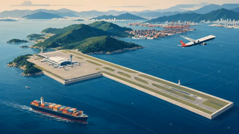
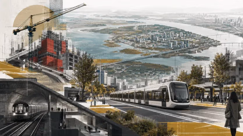
BUSAN — Busan’s latest transport approval for Eco Delta City looks, at first glance, like another local infrastructure update. A bus rapid transit plan has been removed from the city’s transport framework for the new town, a tram has been inserted in its place, and officials are presenting the change as an early step toward a more stable public transport system in the city’s west.
The decision deserves more attention than a routine planning revision. Eco Delta City is not an isolated housing district waiting for one more route on a map. It sits inside a wider western corridor where Busan is trying to connect Hadan, Myeongji, Noksan, Daejeo and the Nakdonggang River Estuary while absorbing new residential districts, industrial roads and long-delayed rail projects. A change in the transport plan for Eco Delta City therefore does more than revise one development document. It exposes how Busan is beginning to divide its western transit future between two very different models: rail below difficult ground, and surface transit that stays closer to streets, stops and daily movement.
The revised metropolitan transport improvement plan, approved this week by the Ministry of Climate, Energy and Environment, replaces the BRT element included in the original 2014 framework with a section of the Gangseo tram line inside Eco Delta City. Busan describes the change as a response to altered transport policy and changing conditions around the new town. In practical terms, the approval brings a 6.6-kilometer Eco Delta City tram section into the official plan and links it to the larger Gangseo Line, a proposed tram corridor running from Daejeo Station through Eco Delta City and Myeongji International New Town toward Myeongji Ocean City.
The approval does not mean trams will soon be running through Eco Delta City. It marks the acceptance of a planning direction, not the arrival of vehicles, tracks and stations. The Gangseo Line still has to move through the remaining national and local procedures that separate a transport concept from a working railway. Yet the decision changes the debate because Busan has now formally placed surface rail at the center of a major western new-town corridor.
A Tram Approval That Reopens an Older Question
For years, West Busan’s transport conversation has been shaped by a different assumption. When a district needed stronger transit, the default answer was often some version of an underground or grade-separated rail project. That logic produced large promises, but it also produced long schedules, high costs and complicated construction risks in places where the ground itself is not a neutral backdrop.
The Hadan–Noksan Line remains the clearest example of that unresolved model. The line is not a project Busan can dismiss. It is meant to extend the city’s western rail spine from Hadan through Eulsukdo and Myeongji toward the Noksan National Industrial Complex, a corridor where buses have long carried more of the burden than a metropolitan city should expect them to carry alone. For residents in Myeongji, workers in Noksan and travelers moving between the older subway network and the newer western districts, the need for stronger transit is real.
The difficulty lies in the form that need has taken. The current plan calls for a 13.47-kilometer rubber-tired light metro with 11 stations and one depot, running from Hadan Station toward the industrial edge of western Busan. It is supposed to give the city’s far west a durable public transport spine, connecting residential districts, industrial employment and future growth areas to the existing urban rail network.
Yet the line remains in basic and detailed design. After earlier plans pointed toward a 2026 start, the project entered a new design phase following a difficult procurement process. Recent local reporting places the target for contractor selection and construction in the first half of 2028, after an estimated 18-month design period. The schedule matters because it shows how far the project still is from the public experience of a train, even after years of planning and political support.
The delay should not be read as evidence that the corridor lacks importance. It points instead to the weight of the construction model. Hadan–Noksan is being planned across one of Busan’s most complicated western landscapes: soft delta ground, the Nakdonggang River Estuary, Myeongji’s planned districts, industrial roads and sections where underground work has become part of the project’s political compromise.
The Myeongji section, in particular, has become a symbol of the tension between local acceptance and engineering risk. Moving rail below ground can reduce visual intrusion and respond to residents’ objections to elevated structures, but underground work in this geography also increases cost, construction complexity and the burden placed on contractors.
The city has already changed the way it intends to move the project forward. After procurement difficulties, Busan shifted away from a single large design-build package and moved toward separated design and construction, with the route divided into three construction sections. The change may help the project advance, but it also confirms that the earlier structure did not comfortably match the risk profile of the corridor. In infrastructure planning, a failed or difficult tender is not a clerical inconvenience. It is a signal from the market about how builders price uncertainty.
The Ground Has Already Entered the Public Record
The concern around West Busan’s underground rail projects is no longer only a matter of speculation. The Sasang–Hadan Line, the project meant to connect the existing urban rail network more deeply into the city’s southwest, has already left behind a public record of ground-related safety problems. For any new line planned through the same western geography, that record now belongs inside the transport debate.
In May, police sent eight people to prosecutors over a ground-subsidence accident near the second construction section of the Sasang–Hadan Line. The group included Busan Transportation Corporation officials, construction managers, site managers from the main contractor and subcontractor personnel. Investigators applied professional negligence charges in connection with a September 2024 accident in Sasang-gu, where two vehicles were damaged and one driver reportedly suffered post-traumatic stress after the road gave way near the construction site.
The details move the discussion beyond vague concern about “soft ground.” Investigators identified problems around waterproofing quality tests, injection of waterproofing materials, waterproofing methods and management of earth-retaining temporary structures. Police also said heavy rain was not the only cause; construction-related errors had acted together and in sequence.
One accident does not prove another line cannot be built. Large underground projects are built in difficult ground around the world, and Busan cannot avoid every engineering challenge simply by staying on the surface. The relevance lies elsewhere. West Busan’s ground conditions have already produced consequences visible enough to enter police files, public investigations and local memory. A new project through the delta cannot ask residents to treat geotechnical risk as a technical footnote.
The accident history also changes the burden of explanation. Before the Sasang–Hadan cases, officials could present ground risk as a matter to be handled inside design documents, tender packages and expert review. After repeated subsidence reports and a police referral, the public question becomes more practical: what exactly has changed in waterproofing standards, ground investigation, contractor supervision, emergency response and risk allocation? If Hadan–Noksan is to proceed with underground sections, the city needs to show how the design has absorbed the lesson, not merely assert that the next project will be safer.
Dadaepo Shows That Rail Does Not Equal Access
The same caution applies to the assumption that a subway extension automatically solves a western access problem. Dadaepo offers a useful precedent because Busan has already extended a subway into the far west and framed the project as a step toward regional balance.
When the Line 1 extension from Sinpyeong to Dadaepo Beach opened in 2017, the city described it as a long-awaited improvement for Saha-gu residents and a catalyst for a broader “West Busan era.” The project added six stations over 7.98 kilometers, from Dongmae and Jangnim to Natgae, Dadaepo Port and Dadaepo Beach, and shortened the trip from Sinpyeong to the coast to about 12 minutes.
The extension did real work. It brought Dadaepo Beach and Molundae closer to the subway map, gave residents in Jangnim and Dadae-dong a direct rail connection, and turned the beach station into a seasonal gateway for festivals, sunset tourism and weekend trips. During the first month after opening, the new section carried nearly 25,000 passengers a day, close to the pre-opening forecast. For a district long treated as distant from Busan’s central rail network, the arrival of Line 1 changed the geography of the commute and the image of the coast.
The later lesson is more restrained. A subway can reach a district without making the district fully accessible. Dadaepo gained stations, but the surface city around the western extension remained uneven: wide roads, industrial edges, apartment pockets, port-related spaces and destinations that do not always sit comfortably within a short, legible walk from the platform. The train improved access to named places, especially the beach, but it did not by itself turn the wider river-edge and industrial corridor into a continuous public realm.
That distinction matters for Hadan–Noksan and Eco Delta City. A rail line can shorten travel time between stations while leaving the last part of the trip unresolved. A resident may reach Dadaepo Beach Station quickly and still face a disconnected street network beyond the exit. A worker near Jangnim or Sinpyeong may live close to Line 1 on a map but still depend on a bus, a car or a long walk through road-dominated space. A visitor may arrive by subway for a festival and still experience the rest of the western waterfront as a set of separate destinations rather than a corridor that can be followed without planning.
Dadaepo therefore weakens the simplest argument for extending heavy rail westward. The question cannot be limited to whether a subway line appears on the map. Busan has already shown that a subway extension can improve mobility and still leave much of West Busan’s access problem intact. The more important question is what happens above the station: where people walk, how they transfer, whether buses and surface transit connect to the rail spine, and whether streets near the river are designed as places to move through rather than barriers to cross.
An Aging City Cannot Be Planned From the Platform
The question becomes sharper in an aging city. For a younger commuter, a deep platform may be an inconvenience measured in minutes. For an older rider, the same route can become a sequence of decisions: whether the elevator is easy to find, whether the escalator is working, whether the transfer corridor is too long, whether the final walk from the exit is exposed to traffic, and whether the trip can be repeated often enough to remain part of daily life.
Busan has already crossed the point where those questions can be treated as a special design concern. The city is one of Korea’s oldest large metropolitan areas, and official population statistics show that more than one in four residents is now 65 or older. In transport planning, that demographic fact should change the default user imagined inside the design. The rider is no longer only a peak-hour worker who can absorb stairs, long walks and crowded transfers in exchange for a faster train. The rider is also a pensioner going to a clinic, a resident carrying groceries, a couple traveling slowly to a park, or a person who avoids a trip altogether when the route feels physically or mentally tiring.
Hadan–Noksan is often discussed through engineering categories: route length, station count, vehicle type, construction method and project cost. Those categories are necessary, but they do not capture the full trip. A train may be fast between stations and still produce a difficult journey if the station is deep, the vertical movement is slow, the exit is far from daily destinations, or the surrounding street is hostile to slow walking. For older riders, the trip begins before the train arrives and continues long after the doors open.
Subway planning often hides that cost inside the station. On a map, a station symbol looks the same whether the platform is shallow or deep, whether an elevator is visible or tucked away, whether the nearest exit opens onto a comfortable sidewalk or a road designed mainly for cars. In everyday life, those differences determine whether a line feels usable. A transport system that looks complete from the platform can still fail from the sidewalk.
Surface transit does not solve all of those problems. A bus stuck in traffic can be unreliable, and a tram without priority can become a costly symbol. Buses, trams and tram-grade BRT begin from a different physical premise: the stop is visible from the street, the boarding level can be closer to the sidewalk, and the route can be designed around shorter, more legible access to daily destinations. In an aging city, that closeness is not a minor convenience. It is part of the service.
The Mind Is Also Part of the Transit Map
The same logic extends beyond age. Transport maps flatten the difference between a station and a stop. Riders do not. A subway station and a bus stop may appear as simple points in a route search, but the body understands them differently. One requires a descent into a controlled system of stairs, gates, corridors and platforms. The other waits on the street, visible before the decision to board has fully been made.
A subway trip begins with a small surrender of the surface city. The rider leaves the street, loses the horizon, follows signs, waits in a closed environment and trusts that the next chance to re-enter the city will come at the right exit. For a long commute into a dense center, that bargain can be worthwhile. Speed, frequency and separation from traffic are powerful advantages. For shorter trips across a spread-out district, the same bargain can feel heavier than the map suggests.
Bus and tram trips ask for a different kind of trust. They may be slower, and they are more exposed to traffic unless the city gives them priority. But they remain legible. A rider can see the road, the river, the shops, the apartment blocks, the factories and the next stop. The journey unfolds as part of the city rather than beneath it. For many everyday trips, especially those that do not begin or end directly beside a station, that visibility lowers the mental threshold of using public transport.
West Busan makes that threshold unusually important. The district is not a single dense downtown where a deep station can concentrate thousands of trips around one entrance. It is a wide landscape of housing estates, industrial roads, wetlands, old neighborhoods, new towns and river-edge destinations. In such a place, perceived access can matter as much as measured speed. A route that feels close, visible and easy to understand may be used more often than a faster line that requires a longer walk, a deeper descent or an uncertain transfer.
Younger riders may still choose the fastest and most reliable option, especially for commuting, and a subway can be the obvious choice when the station sits near both ends of the trip. But younger riders also respond to friction. A short trip that requires descending into a station, waiting underground, transferring through corridors and climbing back out may feel less convenient than a surface ride that stops closer to the destination, even if the clock does not fully justify the preference.
Trams occupy a particular space in that psychology. Like buses, they are visible from the street and can be boarded without leaving the surface. Like rail, they offer a fixed route that gives riders confidence the corridor will remain. Tracks tell the city that public transport is not temporary. Stops become part of the neighborhood’s mental map. A tram therefore does more than move passengers. It helps residents understand where the public corridor is.
That advantage disappears if the service is poorly designed. A tram stuck behind private cars will quickly lose the confidence that rail is supposed to provide. A bus that arrives every 20 or 30 minutes may be close in theory and useless in practice. Surface transit only becomes psychologically close when it is also dependable: frequent enough to be taken without planning, protected enough to avoid routine delay, and placed near the destinations people actually use.
A Tram Only Works If the Street Changes
The street is therefore the real test. Underground rail solves one urban conflict by avoiding it. Trains move below the traffic, while the surface can remain organized around cars, trucks, parking, turning lanes and wide arterial roads. That separation is one reason subways are powerful in dense cities. They can carry large numbers of passengers without asking every intersection to become a political argument over road space.
Surface transit cannot avoid that argument. A tram or high-quality BRT only works when the city gives it something more valuable than a route number: priority on the street. Tracks, vehicles and stops may define the project on paper, but the service lives or dies in the lanes, signals and crossings that determine whether public transport moves as a right or waits as a guest among private vehicles.
Calling a line a tram does not make it modern. A tram without dedicated space can be trapped in the same congestion as buses. A tram without signal priority can lose time at every intersection. A tram with stops placed far from daily destinations can become visually impressive but practically weak. Surface rail becomes meaningful only when the city is willing to redesign the street around it.
For West Busan, that willingness matters because the surface is where the access problem is most visible. The western districts are threaded with industrial roads, freight movement, wide vehicle corridors and fragmented pedestrian space. In those conditions, a subway can leave the road order largely untouched. People descend into the rail system, while the streets above continue to serve cars and trucks first. A tram or tram-grade BRT asks the city to make a different choice in public view: which lane belongs to transit, how much delay private traffic should absorb, where pedestrians cross, and whether a station area becomes a place to walk or only a point beside a road.
West Busan does not need to wait for every rail project to be completed before improving access. Frequent buses, bus-priority lanes, shorter transfer walks, better shelters and clearer connections to Line 1, the future Hadan–Noksan Line and the Gangseo tram could change daily mobility sooner than a long construction program. The difference between a weak bus route and a useful surface network is not the vehicle. It is the priority the city gives it.
Where the Nakdonggang Becomes a Barrier
The missing geography in this debate is the Nakdonggang river edge itself. Dadaepo, Jangnim, Sinpyeong, Hadan, Eulsukdo, Myeongji and Eco Delta City are usually discussed through separate projects and separate administrative names: a subway extension at the coast, industrial roads through Saha, a light-metro plan toward Noksan, a tram inside a new town, an estuary park managed as an ecological asset. Seen from the ground, however, they form one broken corridor.
The corridor is not empty. It contains beaches, factories, wetlands, apartment districts, port-related spaces, schools, parks, river views and new development land. The problem is that those places rarely read as one connected public landscape. A resident can know Dadaepo Beach, Jangnim Port, Sinpyeong’s industrial area, Hadan Station, Eulsukdo and Myeongji as separate destinations without experiencing them as a sequence that can be followed easily without a car. West Busan’s geography is close together on a regional map, but fragmented at the scale of the pedestrian, the bus rider and the visitor trying to understand where the next place begins.
That fragmentation is partly the legacy of how the western edge developed. Roads built for freight and commuting move through the area with more confidence than people do. Industrial land, river protection, wetlands and large residential blocks have produced a landscape where access often depends on knowing the correct bus route, the right transfer, the safest crossing or the least hostile walk from a station. The Nakdonggang is nearby, but proximity to the river has not always produced public access to the river. In many places, the river edge functions less as a civic corridor than as a boundary between separate zones.
Rail projects have so far treated that geography in pieces. The Line 1 extension gave Dadaepo a subway connection. The Hadan–Noksan Line is planned as an industrial and regional spine from Hadan toward Myeongji and Noksan. The Gangseo tram line is being positioned as a new-town and western Busan connector through Eco Delta City and Myeongji. Each project may be justified on its own terms. The weakness appears between them, where the everyday surface of the western city remains difficult to read, difficult to walk and difficult to use as one corridor.
A Nakdonggang river-edge transit concept would ask a different question. It would not replace Hadan–Noksan, and it would not reduce the need for strong rail links to industrial employment. Instead, it would examine whether the western waterfront and river-adjacent districts can be connected by a visible surface network: tram, tram-grade BRT, priority bus, or some combination of those modes. The purpose would be less about one fast trip across the west than about making the west usable between its stations.
Such a corridor would have to be designed carefully. Eulsukdo and the Nakdonggang River Estuary are not ordinary urban land waiting to be filled with infrastructure. They are ecological spaces where transport planning has to respect wetlands, bird habitats, flood risk and the limits of new construction. A serious surface-transit proposal could not simply draw tracks along the river and call it regeneration. It would have to work with existing roads where possible, limit new ecological intrusion, and place stops where access can improve without turning protected landscapes into development frontage.
Even with those limits, the idea matters because it changes the frame of the debate. West Busan is often described as lacking rail, but many of its destinations remain disconnected at the surface. A subway can anchor a point. A light metro can connect major nodes. A tram or high-priority bus corridor can make the space between those nodes more legible. In a district where the river, industrial roads and new towns sit side by side, legibility is a form of access.
The comparison with Eco Delta City is instructive. A tram inside a new town can help establish where the public spine will be before car habits harden completely. The same logic could be applied more broadly along the Nakdonggang edge, where many habits have already hardened around driving, road crossings and disconnected trips. If Busan is prepared to give surface rail a role in Eco Delta City, it should also ask whether the older western river-edge districts deserve a similar conversation.
The question is not whether a scenic tram should be placed beside the river for symbolism. West Busan does not need a decorative transit project. It needs a network that makes ordinary trips easier: a worker moving between Sinpyeong and Hadan, an older resident reaching a clinic or market, a student traveling from Myeongji to a library, a visitor trying to reach Eulsukdo without guessing how the final kilometer works. A river-edge corridor would be judged by those trips, not by the attractiveness of the vehicle.
The Real Choice Is Fit, Not Mode
Busan does not need a single transit technology for every western corridor. Hadan–Noksan may still require a stronger rail spine for industrial travel, regional commuting and long-distance movement between the existing subway network and the far west. Eco Delta City and Myeongji may need surface rail that stays closer to daily life. The Nakdonggang river-edge districts may need something more flexible still: priority buses, tram-grade corridors, better transfers and streets designed so that public transport begins before a passenger reaches a platform.
The failure would be to treat those choices as separate announcements. A tram in Eco Delta City, a light metro toward Noksan, a subway extension to Dadaepo and buses along industrial roads all belong to the same accessibility problem. West Busan is not simply short of lines. It is a district where the ground is difficult, the population is aging, destinations are spread out, and the surface city has often been left to cars, freight movement and long walks between disconnected points.
The old question — whether Busan should build more rail westward — is no longer enough. The city has already answered that question in principle. It is planning more rail, and the west needs it. The harder question is what kind of rail, at what depth, with what street priority, serving which riders and connecting to what kind of surface network. A line that looks complete on a map can still feel distant from daily life. A station can be near a neighborhood and still be hard to use. A corridor can be served by transit and still remain difficult to understand without a car.
Hadan–Noksan deserves that more demanding test. Its supporters can point to real needs: Myeongji’s growth, Noksan’s industrial employment, the weakness of current bus dependence and the long-standing imbalance between central Busan and the western districts. Those needs should not be dismissed. But a necessary corridor does not make every design choice inevitable. If the line continues with underground or partly underground sections through difficult ground, the city needs to explain how the design has changed after the Sasang–Hadan ground-subsidence record, how construction risk is being shared, and how stations will serve older riders and scattered destinations above ground.
The Gangseo tram deserves the same scrutiny from the other direction. A surface rail project can sound more humane and less invasive than a subway, but only if it receives the space and authority needed to work. Dedicated track, signal priority, careful stop placement and strong transfer design will matter more than the word “tram” itself. Without those decisions, surface rail risks becoming a symbolic vehicle placed into a road system still governed by cars.
Dadaepo offers the caution between the two. The Line 1 extension made the far west more reachable and improved access to the coast, but it did not automatically turn the wider western river edge into a connected public corridor. That lesson should travel with every new western project. Rail access and usable access are not the same. Busan can build a line to a place and still fail to make the surrounding district easy to move through.
A more credible West Busan strategy would begin by assigning different roles to different corridors. Hadan–Noksan should be evaluated as an industrial and regional spine, with its underground risks and station access made explicit. Gangseo should be evaluated as a surface rail corridor for new-town growth, with its success tied to street priority rather than branding. The Dadaepo–Jangnim–Sinpyeong–Hadan–Eulsukdo–Myeongji–Eco Delta City axis should be evaluated as a Nakdonggang river-edge access corridor, where the missing link may be not another deep station but a visible, frequent and legible surface network.
Such planning would also change the public conversation. Residents would no longer be asked to choose between a subway and a tram as if one were modern and the other obsolete. They would be asked a more practical set of questions: Where do people actually walk? Which trips are too difficult now? Which roads should give priority to public transport? Which stations will older riders avoid? Which river-edge destinations remain unreachable even when they are close on a map?
Eco Delta City’s tram approval should be valuable because it opens those questions, not because it answers them. It shows that Busan can imagine surface rail as part of the west’s future. The challenge is to decide whether that imagination will remain confined to one new-town project, or whether it will force a broader reassessment of the subway-first assumptions still shaping other corridors.
West Busan needs better transit. It also needs transit that fits the place. Along the Nakdonggang, that means planning for fragile ground, aging residents, industrial roads, river-edge destinations and the psychology of access. The future of the west may include subways, light metro, trams and buses. What it cannot afford is to confuse the presence of infrastructure with the experience of access.
Editorial Context
"Independent journalism relies on radical transparency. View our full log of editorial notes, corrections, and project dispatches in the Newsroom Transparency Log."
Reader Pulse
The report's impact signal
Be the first to provide a reading pulse. These collective signals help our newsroom understand the impact of our reporting.
Join the discussion
A more thoughtful conversation, anchored to the story
Atlantic-style discussion for this article. One-level replies, editor prompts, and moderation-first participation are now powered directly by Prisma.
Discussion Status
Open
Please sign in to join the discussion.
The Weekly Breeze
Independent reporting and analysis on Busan,
Korea, and the broader regional economy.