Busan Expands West but the Delta Pushes Back
As Busan pushes its urban frontier into the Nakdonggang River delta, its grand plans collide with the slow physics of mud, water, and distance. The city’s westward expansion promises connection, but the land still speaks in the language of resistance.


Busan’s westward expansion meets the limits of its own geography.
Between the Nakdonggang River to the east and the Seonakdonggang River, the western branch of the Nakdong system, to the west lies a vast plain of contradiction. Here, Busan’s ambition to grow meets the quiet resistance of its own geography. The western corridor of the city—stretching from Sasang-gu District through Gangseo-gu District to the Noksan Industrial Complex—is defined less by its skyline than by its waterlines. It is a geography that keeps promising access while demanding patience. The very terrain that gave Busan its industrial edge now imposes a slower calculus of movement and risk.
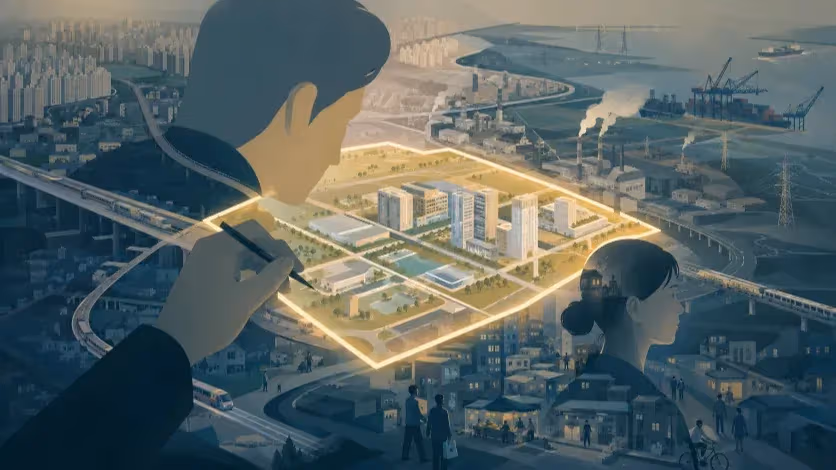
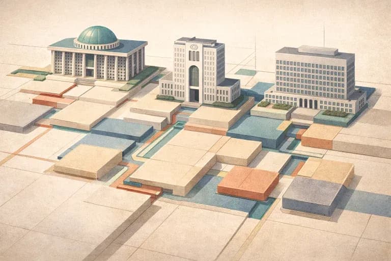
Eco Delta City, the government’s flagship “smart delta” project, sits at this geographic hinge. Designed as a 21st-century model of environmental harmony and urban innovation, the project—still under construction—occupies land that was once tidal marsh: soft, saturated, and unsteady. The city envisions a future where data-driven living coexists with ecological sensitivity. Yet beneath the design language lies a persistent contradiction: the desire to stabilize a landscape that by nature resists permanence.
For all its modern architecture and sustainability rhetoric, western Busan remains a region of divided access. To cross from Eulsukdo Island to Noksan, or from Gangseo-gu District to the central city, one still depends on bridges that rise over water rather than roads that link communities. It is a city perpetually building connections, never quite connected.
Geography of Disconnection
A delta that builds faster than it binds.
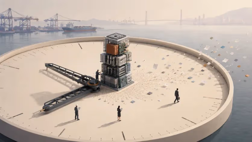
The Nakdonggang delta is not merely a site of development—it is a living system that shifts with every tide. From Daejeodaegyo, still under construction, to Eulsukdodaegyo, already in operation, the city’s infrastructure is an ongoing negotiation with water and silt. The river divides as much as it unites, shaping a geography of fragments. Despite the rhetoric of integration, western Busan remains a mosaic of isolated clusters—industrial zones, new housing districts, and planned eco-cities—each separated by the invisible logic of topography and flood risk.
This geography creates a paradox of proximity. On the map, Gangseo District sits a short distance from Busan’s core; in practice, the commute is defined by detours through toll bridges and tunnels. Residents moving between the industrial belt of Noksan and the business center at Centum City often traverse multiple toll points, their “fifteen-minute city” commute stretching into a forty-minute negotiation with infrastructure. The problem is not simply congestion but design: a linear city built along a coastline pretending to be circular.
Even where development accelerates—Eco Delta City (under construction) to Myeongji to Noksan—the connective tissue lags behind. Bridges such as Eulsukdodaegyo (in operation), and the planned Daejeodaegyo, Jangnakdaegyo, and Eomgungdaegyo, form critical arteries on paper, but they also represent the cost of separation. Each one is both achievement and admission: proof that the city still requires extraordinary effort just to touch itself.
The Frontier Logic
From reclaimed land to reclaimed language.
Western Busan has long been treated as a frontier—a zone of potential rather than belonging. Since the 1970s, land reclamation projects have redrawn the boundaries of the delta, transforming tidal flats into industrial estates and logistics corridors. Each new parcel of reclaimed ground carried the same promise: expansion, efficiency, modernization. Yet every reclamation also deepened a subtle alienation between the city and its terrain.
The language of development followed suit. Phrases like “global hub,” “innovation district,” and “eco-smart zone” began to replace the older vocabulary of river, marsh, and field.
What was once a hydrological reality became an economic metaphor. In the bureaucratic lexicon of the city, water ceased to be an ecosystem and became an obstacle—something to be managed, rerouted, and built upon. The delta’s pulse was reinterpreted as a data problem.
Eco Delta City represents the culmination of this linguistic reclamation. It reimagines the floodplain as a showcase of human control: sensors regulating water levels, AI managing energy flow, architecture designed to “float” on resilience. But control, in a delta, is always temporary.
The soft soil beneath the project has already revealed its instability through multiple sinkhole incidents in nearby zones—most notably along the Sasang–Hadan Line and the Bujeon–Masan Corridor, where ground collapses interrupted construction and forced costly redesigns. These are not mere engineering anomalies; they are reminders that the land remembers its original form.
The ground beneath western Busan remains a delta in motion—a composite of silt, clay, and memory. Every tunnel or pylon erected here must contend with a soil that moves on its own terms. To build upon it is to participate in an ongoing conversation between ambition and erosion.
Connectivity Deferred
Where the map runs faster than the road.
If Busan’s maps promise integration, its roads tell a slower story. The city’s western areas—Gangdong, Daejeo, Noksan, and the planned Seobusan Industrial Complex—exist as cartographic neighbors but infrastructural strangers. Between them run arterial projects conceived to bridge the delta, yet few operate as continuous public corridors. Daejeodaegyo, still under construction, and Eulsukdodaegyo, already in operation, connect the areas in theory, but the lived geography remains fractured by toll gates, restricted zones, and discontinuous highways. Each new crossing improves visibility rather than access.
Nowhere is this more apparent than in the planning of the Hadan–Noksan Line, a long-delayed urban rail link intended to connect the southern industrial belt with Busan’s subway grid. First proposed more than a decade ago, the project has faced repeated postponements due to financial strain, environmental objections, and engineering concerns about the weak Nakdonggang deltaic substrate. The line, running through the heart of Eco Delta City—still under construction—and Gangdong, would theoretically bind the west into the metropolitan rhythm. Yet as of late 2025, it remains a negotiation among ministries, contractors, and shifting soil.
Even for private vehicles, mobility depends on a fragile logic. Busan’s western arteries — Garak-daero, Gonghang-ro, and Noksansaneop-daero — operate at near capacity during rush hours. Planned expansions promise relief, yet they also risk deepening the pattern of car dependency that the city’s “15-minute” vision was meant to reduce. A toll policy designed to encourage inclusion paradoxically reinforces exclusion: commuters pay for the privilege of connection.
The topography compounds the tension. Each bridge must span not only water but also bureaucracy—coordination between Busan Metropolitan City, the Ministry of Land, Infrastructure and Transport, and the Korea Expressway Corporation. As a result, infrastructure advances not as a network but as a series of isolated triumphs. The map fills with symbols of progress—lines, bridges, interchanges—while the lived city continues to move at the pace of its bottlenecks.
The Price of Building on Water
Engineering against the delta’s memory.
To construct on reclaimed ground is to challenge geology’s patience. Western Busan’s expansion into the Nakdonggang delta involves a constant negotiation with silt, water tables, and subsidence. Engineers describe the region’s soil as “compressible” — meaning it compacts under its own weight. The result is a hidden economy of stabilization: deep piling, drainage layers, and ongoing maintenance that render every square meter more expensive than it appears on paper.
Eco Delta City, a national demonstration project still under phased construction, and the planned Seobusan Industrial Complex occupy land built from dredged material—a composite of clay and sand compacted over years. This makes the area highly susceptible to differential settlement. In several test zones, sensors have already detected subsidence rates exceeding projections, particularly near road embankments and early-stage utility corridors. Officials assure the public that the situation remains within safety margins, yet the long-term implications for flood control and maintenance budgets are profound.
These challenges echo earlier cases: in the late 2010s, sections of the Busan–Jinhae Free Economic Zone experienced foundation instability, prompting millions in reinforcement works. The same conditions now resurface farther inland under new names. For engineers, the problem is less about failure than fatigue — an infrastructure that must be perpetually rebalanced against the water it displaced.
Environmentalists warn of a subtler cost. The delta’s natural filtration systems—wetlands, reed beds, and tidal flats—once absorbed pollutants and moderated floods. Their replacement with impermeable surfaces redirects stormwater toward engineered channels, increasing vulnerability during extreme weather. In a climate where rainfall intensity has risen sharply, this represents a systemic risk disguised as progress. The city builds resilience through concrete, yet each layer of control distances it further from the natural feedback loops it once relied on.
Ecology of a Moving Delta
The river remembers its shape, even when the city forgets.
No city can truly master a delta; it can only coexist with its motion. Busan’s planners know this, yet the language of policy often assumes the opposite. Phrases like “eco-friendly growth” and “sustainable smart city” populate reports, but the hydrology underlying them remains unpredictable. The Nakdonggang River, one of Korea’s longest, carries not only water but sediment—a slow-moving archive of its own geography. Each season, it shifts slightly, redistributing its weight across the floodplain.
Ecologists studying the lower delta describe a pattern of “hydrological memory,” where former watercourses continue to influence subsurface flow even after reclamation. In plain terms, the ground still thinks it is water. This phenomenon complicates everything from foundation engineering to wastewater management. During heavy monsoon cycles, subsurface channels reactivate, causing uneven saturation and undermining construction zones. The city responds with more pumps, deeper pilings, and stricter zoning. The delta responds with reminders.
At the same time, the very act of developing Eco Delta City has altered migratory bird habitats and salinity levels in surrounding wetlands. The Ministry of Environment’s own reports acknowledge localized ecological stress, particularly near the Gangseo tidal reserves. Urban expansion and ecological compensation coexist in uneasy symmetry — for every new housing district, a fragment of wetland is rebranded as an “eco-park.”
The tension is not simply environmental; it is existential. The delta that once defined Busan’s edge now defines its future risk. In attempting to transform a living ecosystem into a fixed urban platform, the city risks turning adaptability—the delta’s strength—into vulnerability.
The Myth of the Fifteen-Minute City
When a slogan travels faster than the street.
Busan’s western transformation has unfolded under a global slogan: the “15-Minute City.” Imported from Paris and repurposed as a civic mantra, it promises proximity as progress—a life where daily needs sit within walking distance. Yet in the delta, the idea collapses under geography. This is a city stretched forty-five kilometers along a coastline hemmed by mountains and sea. Its density is linear, not circular; its communities organized along corridors rather than clusters.
Officials invoke the 15-minute ideal to frame projects like Eco Delta City, the planned Seobusan Industrial Complex, and the Gangseo Innovation Belt as models of compact urbanism. Yet the evidence remains anecdotal. No data confirms that residents can reach schools, clinics, or workplaces within the promised radius. Meanwhile, public spending continues to favor highway expansion and toll-road maintenance over walkability or public transit. The paradox is unmistakable: proximity is preached, velocity is funded.
For the residents of western Busan, the slogan often feels ironic. A daily commute from Gangdong to Seomyeon can take nearly an hour, involving two transfers and a bridge crossing. Public transport remains coastal in orientation; bus routes fade as terrain rises. The “15-minute” life exists largely in municipal presentations and marketing visuals, not in the rhythm of daily movement.
Urban analysts have begun to question the political logic of proximity. Across Asia, similar slogans—Bangkok’s “Compact Living Districts,” Manila’s “20-Minute Communities”—struggle to reconcile aspiration with topography. In Busan’s case, the tension is heightened by toll economics: a system that monetizes movement while proclaiming accessibility. Scholars now propose a “Multi-Core 30-Minute City” as a more realistic alternative, focusing not on distance but on reliability—the time it actually takes to move between key hubs such as Haeundae, Seomyeon, and Gangseo.
The city’s attachment to the 15-minute ideal thus reveals more than misplaced optimism; it exposes a linguistic gap between policy and terrain. The map may depict circles of access, but the lived city remains a sequence of corridors—each shaped by water, cost, and time.
A Corridor in Waiting
Where development moves faster than connection.
The western corridor of Busan has become the city’s most ambitious experiment—and its most revealing contradiction. Projects such as the planned Seobusan Industrial Complex, the second-phase cluster of Eco Delta City still under construction, and the proposed Triport logistics zone near the new Gadeokdo International Airport project an image of coordinated progress. Yet beneath this surface lies an urban condition defined by anticipation: roads that end in temporary fences, bridges that lead to unfinished embankments, and zoning maps still waiting for signatures.
In Gangdong-dong, where the newly approved industrial zone will rise, the pattern repeats. The project’s scale—nearly 1.4 square kilometers—signals industrial renewal, but its success depends on connections that remain incomplete. Without the Hadan–Noksan Line, still delayed, workers and freight will continue to rely on road corridors already strained by commuter traffic. Planners speak of “integrated development,” but each new district must first negotiate its own isolation.
The corridor logic also reshapes social geography. Public amenities cluster around planned centers, leaving transitional zones underserved. In Myeongji District, newly built schools and housing towers stand within sight of empty plots marked “future access.” Residents find themselves pioneers in a geography still under construction—a frontier of convenience that never quite arrives.
Financially, this model depends on momentum. Each phase of construction justifies the next; land values rise on the expectation of eventual linkage. But when infrastructure lags, confidence erodes. Local businesses speak of “invisible tolls”—the cost of waiting. For them, connectivity is not a metaphor but a daily expense measured in logistics, fuel, and lost hours.
Still, Busan continues to treat the west as its frontier of renewal. The city’s leadership envisions a tri-axial model: Haeundae for finance and tourism, Seomyeon for culture and services, and Gangseo for logistics and innovation. It is an elegant diagram—one that awaits translation into asphalt and timetables. The promise of a “balanced Busan” remains suspended between drawing and ground.
Reclaiming the Narrative
Beyond slogans, toward a geography that speaks truth.
Every city eventually must decide which story it believes about itself. For Busan, the story of the 2020s has been one of proximity—of becoming a “15-minute city” in name if not in structure. But as bridges age and corridors stall, another story emerges: a city whose geography still dictates its politics.
The truth is less convenient than the slogan. Busan is not a compact circle but an elongated delta—a geography that moves, absorbs, and resists containment. To plan within it requires not simplification but acknowledgment. The task ahead is not to erase distance but to manage it honestly: to design infrastructure that accepts delay as part of the delta’s rhythm, to measure success not in slogans but in seconds saved and lives improved.
Reclaiming the narrative means restoring precision to language. Terms like “eco,” “smart,” and “inclusive” must return to measurable ground. If Busan aspires to lead in sustainable urbanism, it must first confront the arithmetic of its terrain: the tolls that fragment its mobility, the soil that defies permanence, and the rivers that keep redrawing its borders. Honesty, not optimism, will define its next transformation.
This does not mean retreat from ambition. Busan’s history is one of persistence—rebuilt after war, reshaped by trade, connected through courage. Its engineers once carved tunnels through mountains and raised bridges across the sea. That same ingenuity can now be redirected inward: toward equity in access, transparency in cost, and realism in design. The “city between rivers” has always balanced on the tension between movement and memory.
To move forward, Busan must reclaim its geography as both limit and guide. The delta is not an obstacle to overcome but a teacher to learn from. Its resilience offers a model for adaptation—flexible, layered, and enduring. If the city listens to its terrain, it may finally achieve what its slogans have long promised: not a 15-minute fiction, but a lived, connected truth.
Editorial Context
"Independent journalism relies on radical transparency. View our full log of editorial notes, corrections, and project dispatches in the Newsroom Transparency Log."
Reader Pulse
The report's impact signal
Be the first to provide a reading pulse. These collective signals help our newsroom understand the impact of our reporting.
Join the discussion
A more thoughtful conversation, anchored to the story
Atlantic-style discussion for this article. One-level replies, editor prompts, and moderation-first participation are now powered directly by Prisma.
Discussion Status
Open
Please sign in to join the discussion.
The Weekly Breeze
Independent reporting and analysis on Busan,
Korea, and the broader regional economy.