Outdated Urban Planning Is Sinking Busan — Literally
Repeated sinkholes in Busan expose outdated urban planning as climate change and unstable soils put infrastructure at risk.


Busan, South Korea — It was just after 11 on a damp August morning when the road outside Saebyeok Market gave way. The air hung thick with humidity. Then came a sharp crack, a shudder in the asphalt, and a section of pavement dropped out from under a passing one-ton truck. Its back wheels sank into the hole — a jagged mouth of earth, about a meter deep and three meters across.
This wasn’t the first time. Not even close. Since tunneling began for the Sasang–Hadan Metro Line, the Hadan–Sasang corridor has seen fifteen sinkholes. Many opened within meters of the digging. Beneath the streets lies soft alluvial ground — silt and clay the Nakdonggang River has been laying down for centuries. It shifts under weight, turns to slurry when soaked, and in heavy rain it loses what little strength it has. Those rains are coming harder now, and more often.
To treat these events as one-off accidents is to miss the point. They are warnings from the ground itself, reminders of how geology and climate can work together to test whatever we build on top of them. The question is whether Busan’s planners are willing to listen.
The city is pressing on with other big underground works — the Hadan–Noksan Line, the much-touted Gadeokdo New Airport. In both cases, deadlines are political, budgets are fixed in ink, and risk assessments are filed like paperwork instead of forming the backbone of the plan.
What’s unfolding here is larger than a string of sinkholes. It’s the story of a coastal city, aging and flood-prone, trying to push forward with twentieth-century playbooks in a century that no longer works that way. The stakes aren’t just about engineering; they’re about whether Busan can adapt before the ground, quite literally, gives way.
Soft Soils and a Shifting Climate
The Nakdonggang River delta is a landscape built on patience. Over millennia, the river carried fine sediment from deep inland, laying it down in layers that now underlie much of Busan’s western districts. These deposits — soft clays and silts interspersed with organic material — are geologically young.
They have not compacted into the dense, load-bearing formations found in older terrains. Instead, they behave like a slow-moving liquid under sustained weight, and their stability changes with the seasons.
In engineering terms, this means the ground has a low bearing capacity and high compressibility. That alone is manageable if designers are willing to work with long timelines and substantial reinforcement.
What complicates matters in the 21st century is the overlay of climate-driven hydrological stress. Busan’s annual rainfall is no longer spread evenly across the year. The city has seen a marked increase in short-duration, high-intensity storms — the kind that dump 100 millimeters or more of rain in just a few hours.
These bursts saturate the upper soil layers, pushing water into voids and loosening the delicate bonds that hold the sediments together. In tunnel construction zones, where the ground is already disturbed by excavation and dewatering, the loss of soil cohesion can trigger localized collapses.
Sometimes these manifest as small surface cracks. Other times, as Sasang residents have seen, they open into sinkholes large enough to swallow a truck.
Despite this, Busan’s underground transit expansion projects have not significantly altered their geotechnical risk protocols in the past decade. Reports often reference mitigation measures — grout injection, sheet piling, staged excavation — but these are calibrated to historical norms.
They do not yet fully incorporate the probabilistic modelingnow used in climate-adaptive engineering, which factors in future rainfall extremes and groundwater fluctuations over a project’s full lifespan.
This gap between traditional engineering practice and emerging environmental reality is at the core of why soft soil regions in Busan keep producing unwelcome surprises.
And as we will see, it is not only an engineering problem — it is also a planning and governance problem that determines whether those engineering warnings are heard, acted upon, or quietly filed away.
Governance and Policy Inertia
The sinkhole outside Saebyeok Market was patched within a day, but the systemic vulnerabilities it revealed will not disappear so easily. The official response followed a familiar sequence: emergency crews secured the site, city engineers performed a rapid assessment, and a public statement reassured residents that the incident was under control.
What was missing — and what has been missing for years — was any visible shift in planning philosophy.
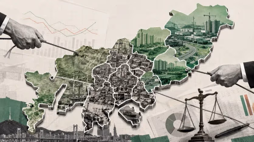
Busan’s infrastructure decisions still tend to begin with political declarations and end with technical adjustments, rather than the other way around. Large projects such as the Sasang–Hadan Line, the planned Hadan–Noksan Line, and the Gadeokdo New Airport are announced with fixed timelines and headline budgets, often tied to electoral cycles.
Once these parameters are public, they harden into political commitments. Risk assessments, environmental studies, and community consultations are then conducted within the narrow space left by those commitments, which limits their ability to influence the project’s scope or pace.
This sequencing leaves little room to address the realities of a changing climate, an aging population, and shifting urban mobility patterns. In a city where more than 20 percent of residents are already over 65, transit planning still assumes a commuter model built for younger, able-bodied riders.
Metro stations require deep descents; transfer corridors can be hundreds of meters long. For older residents — and for anyone with mobility impairments — these design features create friction that reduces ridership, no matter how modern the trains.
Governance culture compounds the problem. The institutional memory of past infrastructure failures is fragmented, with lessons learned in one agency not always carried forward into the next project.
Sinkholes on one line are treated as isolated construction flaws, not as case studies for citywide design standards. When climate scientists warn of more frequent extreme rainfall events, those projections are noted but not fully embedded in engineering models or construction contracts.
In effect, Busan’s planning apparatus remains calibrated to the conditions of the 1990s — a period of rapid growth, stable climate patterns, and a younger demographic profile.
The mismatch between those assumptions and today’s environmental and social realities is not just a technical oversight. It is a governance failure with measurable, and potentially escalating, costs.
The Limits of Legacy Transit Thinking
Busan’s transportation planning still leans heavily on the logic of the late 20th century: build heavy rail metro lines as the backbone of urban mobility, assume high-density ridership patterns, and measure success by the length of track laid rather than the breadth of mobility options provided.
This approach once made sense in a rapidly industrializing city with concentrated employment hubs. Today, the landscape is more fragmented — both physically and demographically.
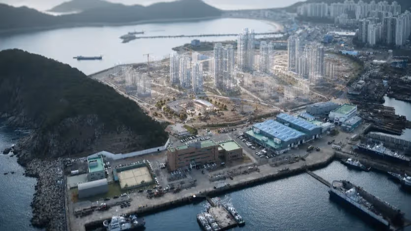
In areas like Myeongji International New City and Eco Delta City, the urban form is defined by large apartment clusters separated by wide arterial roads, open land, or undeveloped parcels.
The street grid prioritizes car access, with generous road widths and expansive parking, while shaded pedestrian corridors or mixed-use street life — features that encourage walking to transit — are scarce. In the peak of summer, when midday temperatures push toward 35°C and shade is minimal, residents default to private vehicles even for short trips.
Heavy rail systems are ill-suited to this dispersed, climate-sensitive mobility pattern. Stations must be spaced far enough apart to justify their construction cost, which means many residents face a 15–20 minute walk to the nearest platform — an impractical distance for older adults, families with small children, or anyone carrying heavy goods.
Once underground, long escalator rides and transfers through deep concourses can make the overall journey slower and less convenient than driving.
The planned Hadan–Noksan Line risks repeating the same mismatch. Its projected ridership models appear to assume commuter flows and walking habits from the early 2000s, without accounting for today’s aging population, declining birth rates, and the steady rise in single-person households whose travel behavior differs sharply from traditional family commuters.
Once such infrastructure is built, it is difficult and costly to adapt — unlike surface-based modes such as trams or bus rapid transit, which can be realigned as development patterns change.
In this sense, Busan’s transport network is being expanded as though urban form and climate pressures are static, when in reality both are in flux. The result is a system that may look complete on a map but leaves large swaths of the population underserved in practice.
New Towns, Old Mistakes
The problems visible in Busan’s transport network are not limited to individual projects; they are embedded in the way the city conceives its new urban districts. Developments such as Myeongji International New City and Eco Delta City were marketed as modern, sustainable, and future-oriented.
Yet their street layouts, building typologies, and mobility patterns often replicate the very urban shortcomings they were supposed to transcend.
Both areas feature broad boulevards and generous green buffers between residential towers. On paper, these features promise openness and light. In practice, they create physical separation between everyday destinations, forcing residents to rely on cars for even the most routine trips.
Retail and service clusters are concentrated into a few nodes, meaning a walk to the nearest café, clinic, or grocery store can require crossing multiple multi-lane roads. For the elderly or those without private vehicles, these environments are not just inconvenient; they are exclusionary.
Eco Delta City’s “water-friendly” branding highlights canals and open spaces, but in the peak of summer those areas can be unshaded expanses, discouraging walking or cycling.
Without microclimate-sensitive design — tree canopy, colonnades, or shaded seating — the environmental concept remains more a marketing point than a lived reality. Myeongji faces similar issues: the public realm is formally generous but functionally sparse, offering few reasons to linger or walk except out of necessity.
These urban forms interact poorly with fixed heavy rail systems. If stations are built to serve these districts, they tend to be located at their peripheries or along a single axis, leaving large residential clusters beyond comfortable walking range. The absence of fine-grained, climate-resilient pedestrian infrastructure means that, even where public transport exists, residents often find it easier to drive.
What emerges is a paradox: new towns promoted as sustainable end up generating mobility patterns more dependent on cars than the older urban districts they were meant to improve upon. And because the underlying design logic is repeated across projects, each “innovation town” risks becoming another iteration of the same planning blind spots.
Infrastructure at a Crossroads
Busan’s current trajectory in infrastructure development stands at a critical juncture. Major projects like the Hadan–Noksan Line and the Gadeokdo New Airport are framed as transformative investments, yet their planning processes reveal a deeper structural rigidity.
The approach assumes that physical infrastructure alone will catalyze urban renewal, without integrating the softer but equally vital layers of adaptation: climate resilience, demographic realism, and flexibility for unforeseen changes.
The persistence of these blind spots stems partly from the procurement model. Public tenders reward speed of approval and construction starts over long-term adaptability. Risk assessments often focus narrowly on engineering feasibility, not the social, climatic, and economic uncertainties that will shape the project’s usefulness over decades.
The result is infrastructure designed for a snapshot of present-day assumptions — assumptions that are already being eroded by accelerating environmental and demographic shifts.
The situation is compounded by the aging and vulnerability of existing underground systems. Many of Busan’s older subway lines and drainage tunnels were built in an era before climate volatility was a planning variable.
Now, heavier downpours, rising sea levels, and land subsidence risks — especially in reclaimed or soft-soil areas — mean maintenance demands will grow even as the city commits to new capital-intensive projects. Without a recalibration of priorities, new lines could be completed only to see the older network struggle under climate stress.
This convergence of outdated planning logic, fragile urban form, and escalating environmental risk presents Busan with a stark choice. It can either continue building in ways that replicate the vulnerabilities of the past, or use this moment to fundamentally realign infrastructure policy toward resilience, adaptability, and human-centered design.
Toward a New Planning Paradigm
Reversing the trajectory of reactive, infrastructure-first urban development in Busan will require more than project-level adjustments. It demands a structural change in how the city defines success and measures progress.
Instead of equating large-scale construction with modernization, the planning framework must pivot toward resilience, inclusivity, and adaptability. This shift means placing climate modeling, demographic trends, and social equity at the very center of infrastructure decisions — not as peripheral add-ons.
A climate-conscious strategy would start by embedding environmental risk assessment into every stage of design. In practice, that means mapping vulnerabilities to flooding, subsidence, and heat stress before deciding on alignment for a subway or the footprint of an airport.
It would also require scaling investment in green and blue infrastructure — tree canopies, stormwater retention systems, coastal buffers — so that transit systems and public spaces are not only functional but protective under extreme weather scenarios.
Demographically, the city must reconcile its transport investments with the realities of an aging and shrinking population. This entails shifting resources toward modes that minimize barriers to access, such as surface-level light rail or hydrogen trams, rather than doubling down exclusively on deep-bore subways.
It also calls for flexible route planning that can expand or contract with demand, and for integrating local mobility options — shuttles, cycling networks, and pedestrian connectors — into the backbone transit system.
Equally important is the governance dimension. Busan’s planning agencies must move away from siloed decision-making, where transport, housing, and environmental policy operate on separate tracks.
A coordinated, iterative planning process — one that continually reassesses assumptions and invites public scrutiny — would help avoid the pitfalls of locking into outdated project concepts. The emphasis should be on building systems that can evolve, rather than monuments that may be obsolete before they are complete.
If Busan embraces this paradigm shift, it could transform its infrastructural vulnerabilities into a proving ground for adaptive urbanism in the era of climate change.
If it does not, the city risks repeating the cycle of ambitious announcements, costly build-outs, and underperforming outcomes that has marked too much of its recent urban history.
Editorial Context
"Independent journalism relies on radical transparency. View our full log of editorial notes, corrections, and project dispatches in the Newsroom Transparency Log."
Reader Pulse
The report's impact signal
Be the first to provide a reading pulse. These collective signals help our newsroom understand the impact of our reporting.
Join the discussion
A more thoughtful conversation, anchored to the story
Atlantic-style discussion for this article. One-level replies, editor prompts, and moderation-first participation are now powered directly by Prisma.
Discussion Status
Open
Please sign in to join the discussion.
The Weekly Breeze
Independent reporting and analysis on Busan,
Korea, and the broader regional economy.