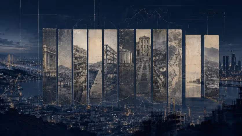
Dalmajigil and the Misreading of Busan’s “15-Minute City”
On a hillside where cars crawl and pedestrians cling to the curb, Busan’s vision of the “15-Minute City” meets its physical limit. Dalmajigil Park promises harmony between nature and culture — but exposes how proximity, without mobility, remains only a slogan.


Busan, South Korea — When city officials broke ground for Dalmaji Park in October 2025, the announcement echoed a familiar formula: sustainability, proximity, livability. The project was folded into Busan’s “15-Minute City” campaign — a vision of neighborhoods built around accessibility and ecological balance. Yet the chosen site told another story. The new park rises from the crest of Dalmajigil Road, a narrow and winding slope that already strains under its own success. Cars crawl uphill toward the cafés and galleries that line the ridge; pedestrians hug the edge of the asphalt for lack of sidewalks. Here, the rhetoric of accessibility meets its topographic limit.
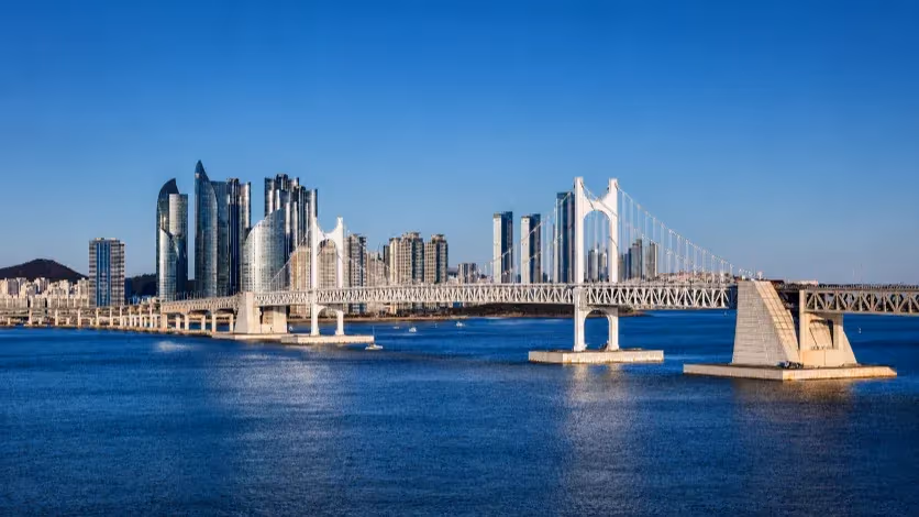
Dalmajigil Road is both postcard and choke point. The two-lane corridor along Haeundae’s eastern ridge was never built for the crowds it now draws. Traffic data from the Busan Transportation Information Center show that daily volumes have more than doubled since 2018, topping 20,000 vehicles during peak tourist months. More than seventy percent are private cars. The road is the only continuous link between Haeundae, Cheongsapo, and Songjeong — three of the city’s most visited coastal spots — and congestion has become routine even on weekday mornings. In some sections the slope exceeds twelve percent, leaving little room for widening or for a dedicated transit lane. Residents describe a landscape of perpetual crawl: slow ascents, stalled intersections, and summer days when the hill turns into a static queue of brake lights.
Dalmaji Park, budgeted at 166.9 billion won and due for completion in 2028, will occupy about 33,000 square meters at the hill’s summit. The city calls it a showcase of “nature and culture in harmony,” led by landscape architect Jung Young-sun. Design renderings show gardens, small performance spaces, and walking trails meant to preserve the site’s natural contours. What the plans do not show is how people are expected to reach it. The traffic impact study has yet to be released. There are no published proposals for shuttle routes, parking restrictions, or micro-mobility links. For now, the park’s only gateway is the same overburdened road that residents already view as saturated.
The decision to add a new attraction to one of Busan’s most constricted corridors reflects a wider habit in the city’s planning culture: complex mobility problems are often translated into visible construction. Busan’s version of the “15-Minute City,” introduced in 2023, borrows the global concept of short-distance living through dense, mixed-use zoning and strong public transport. But in practice it has been expressed as a string of civic projects — parks, libraries, cultural centers — that deliver imagery more than access. The idea of accessibility has been flattened into an aesthetic of proximity.
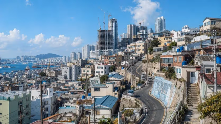
Busan’s geography compounds the difficulty. The city’s core districts are divided by mountain ridges and steep valleys that limit horizontal connectivity. Narrow, winding roads dominate the urban form, especially in older residential areas such as Yeongdo, Dong-gu, and Seo-gu. Many of these areas lack sidewalks or bicycle infrastructure, and steep gradients reduce the functional reach of “15-minute” accessibility to far less than a kilometer. The municipal policy does not reflect these constraints. Instead, it measures success by the number of new amenities within a nominal walking radius, even when topography or street design renders them inaccessible for much of the population.
Dalmajigil Hill illustrates this disjunction. The area’s scenic and economic value has driven dense residential and commercial development without matching transit capacity. Apartments and cafes compete for limited parking, and emergency vehicles often struggle to pass during rush hours. A new park in this setting may add cultural value but not accessibility. It may even worsen conditions if visitor numbers rise without transport control. The city’s promotional framing of the project as a “15-minute urban park” highlights the conceptual drift: the phrase has become a branding device rather than a planning metric.
Urban mobility specialists argue that a 15-minute city cannot be built by distributing static amenities. It depends on functional mobility—the ability of residents to move efficiently between services. That requires redesigning transport systems and spatial regulations to fit local geography. In Busan, this would mean recognizing that the city’s mountainous terrain demands adaptive solutions: hillside elevators, small-scale electric shuttles, or neighborhood-level transit loops that bridge disconnected basins. Without such measures, the placement of parks or libraries has limited structural impact. A public facility may exist “within 15 minutes” by map, but not by experience.
The problem is less about intention than about translation. Busan’s planners have taken a concept born in compact, flat European cities and applied it to a topographically fragmented, car-dependent coastal metropolis. The result is a branding urbanism—a policy vocabulary that signals progress while leaving structural conditions unchanged. Dalmajigil Park’s inclusion under the 15-minute umbrella exemplifies this approach: the city imports global language without adapting it to local form. The plan speaks of proximity, but the slope speaks of constraint.
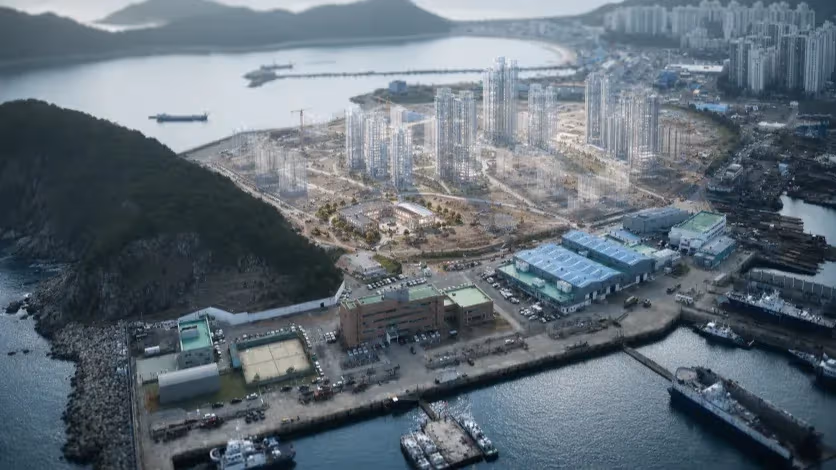
Since 2022, Busan has invested more than 5.7 trillion won to reclaim seventeen long-delayed urban parks, securing 1.6 million square meters of green space. These achievements are substantial, but they also reveal a pattern of amenity-driven development—high-visibility projects concentrated in select districts, rather than mobility reforms spread across the network. In a city where steep terrain and narrow roads define urban life, green space expansion alone cannot equal livability. The infrastructure that allows movement—transport, circulation, and connective design—remains underdeveloped.
Busan’s dilemma lies not in its lack of ambition but in its misalignment between vision and geography. The city has embraced the global vocabulary of the “15-Minute City” without reconstructing it through its own physical and social realities. In a metropolis carved by mountains, layered by tunnels, and divided by narrow corridors, the replication of flatland planning models is conceptually flawed. The result is a pattern of exhibition urbanism—design-heavy, slogan-driven, and politically photogenic—where public works substitute for structural reform.
Under this model, Busan continues to build what can be seen rather than what can be reached. The city’s recent expansion of parks, libraries, and cultural facilities reflects a genuine commitment to public space, but it also reveals an administrative logic that equates visibility with accessibility. The “15-minute” label, once meant to describe a measurable system of proximity, has become a decorative term applied to new construction. What emerges is a network of impressive facilities without a coherent framework of movement connecting them.
The deeper issue is that Busan’s 15-minute agenda was never localized. The city imported a global concept designed for horizontal density and applied it to a topography defined by vertical separation. Rather than formulating a “Busan-type” model—one adapted to steep neighborhoods, micro-transit, and multi-level connectivity—the administration reproduced the aesthetics of the idea without its mechanics. The failure is not in execution but in translation: a misunderstanding of accessibility as architecture, and of livability as landscape.
In this context, Dalmajigil is not merely a case study of traffic congestion but a metaphor for policy inertia. The slope embodies the city’s paradox: a vision of movement built upon static ground. Every stalled car on its narrow ascent signals the limits of a planning culture that values form over function. Until Busan recalibrates its urban policy to start from geography rather than from imagery—to design for movement before monument—the promise of the “15-minute city” will remain a language of aspiration, not a framework of life.
As Mike Biddulph of Cardiff University has argued, urban design fails when it reduces the wicked complexity of cities to drawings.
Editorial Context
"Independent journalism relies on radical transparency. View our full log of editorial notes, corrections, and project dispatches in the Newsroom Transparency Log."
Reader Pulse
The report's impact signal
Be the first to provide a reading pulse. These collective signals help our newsroom understand the impact of our reporting.
Join the discussion
A more thoughtful conversation, anchored to the story
Atlantic-style discussion for this article. One-level replies, editor prompts, and moderation-first participation are now powered directly by Prisma.
Discussion Status
Open
Please sign in to join the discussion.
The Weekly Breeze
Independent reporting and analysis on Busan,
Korea, and the broader regional economy.