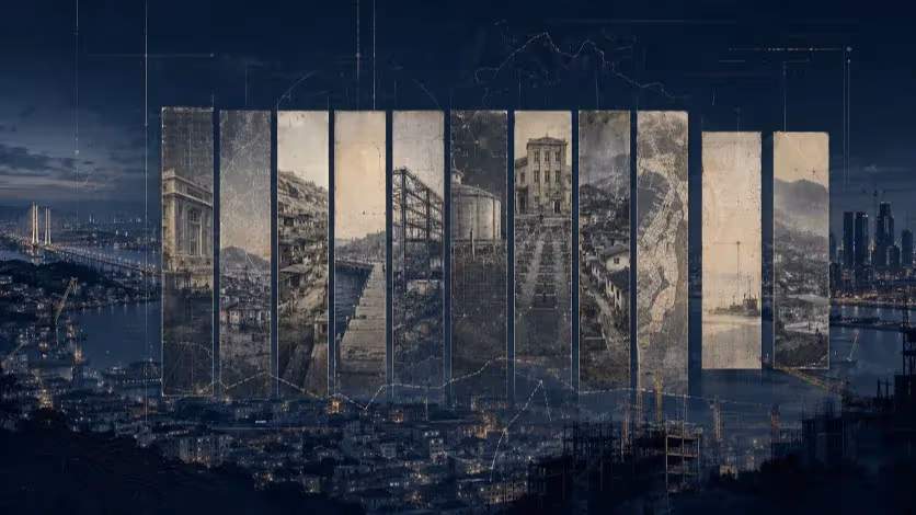
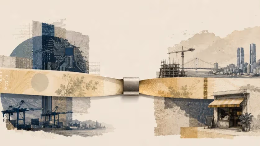
Busan’s Endless Expansion and the Limits of Growth
Each era called it progress, but the pattern never changed. Busan filled its seas and rivers to build new ground, trading geography for growth. A century later, the city faces the question it has long avoided—what to stand for, not just where to stand.


For more than a century, Busan has fought against its own geography. Wedged between granite hills and an uneasy shoreline, the city learned early that expansion would not come from within but from the sea it faced. The water that once defined its limits became its raw material. Each generation, confronting different crises, responded the same way: by pushing the coastline further out.
Colonial engineers filled the shallows to build a modern port; postwar planners buried tidal flats to house refugees and factories; and developers of the new millennium poured concrete into the bay, promising “eco,” “smart,” and “global” futures. Every era gave the same solution a new name. When the city ran short of land, of jobs, or of direction, it reclaimed the sea—and called it progress.
That reflex created a metropolis that grew in size but not in strength. The shoreline advanced, yet the economy retreated. Manufacturing that once animated the valleys vanished by the 1980s, replaced by logistics, events, and real-estate finance. Busan kept building, but each new layer of reclaimed land carried fewer reasons to exist. The port moved cargo that it no longer produced; the cranes kept working, but fewer of them built ships.
Along the waterfront, the city’s modern symbols—Marine City, Centum City, and Eco Delta—stand on the same engineered ground. Their language has evolved from “industrial hub” to “creative city” to “sustainable smart district,” but the foundation remains the same. Physical expansion has replaced economic reinvention. What began as a survival tactic has hardened into habit.
Inland, the hills that once sheltered refugees are fading into silence. Houses sag against the slopes, aging with their owners; narrow stairs climb past locked doors. The geography that once absorbed the shocks of war now registers the slow violence of neglect. The imbalance between a glittering shoreline and a hollowing core defines Busan’s present more vividly than any skyline.
After a century of engineering, the city stands at another threshold—not of land, but of purpose. Reclamation gave Busan ground to stand on; now it must find what to stand for.
How Busan’s Map Was Engineered
Busan’s modern form began not with planning, but with power. When Japan annexed Korea in 1910, the small port on the southeastern coast was reimagined as an imperial gateway to the continent. The obstacle was physical—there was no flat land to build the kind of colonial city the empire required. The solution was to make some.
Between 1906 and 1912, Japanese engineers filled the tidal flats of Choryang and Nampo, dredging the bay to create more than two million square meters of new ground. On that artificial plain rose bonded warehouses, customs offices, and a rail terminal linking the port directly to Osaka and Nagasaki. Each layer of imported soil marked not only technical progress, but political control. The coastline itself became an instrument of empire.
The layout of the new city encoded its hierarchy. Reclaimed lowlands were reserved for Japanese merchants and administrators, while Korean residents were pushed up the steep hills behind the harbor. Property records from the 1930s valued the reclaimed plots at up to ten times the price of hillside lots. Infrastructure stopped where the slope began. By 1936, Busan’s first official urban plan had formalized the divide: commerce and governance on the flats, labor and survival in the hills. Geography became class, and topography became policy.
When Japan surrendered in 1945, its settlers and officials departed, but the structure they built remained intact. The port’s reclaimed lands—its warehouses, rails, and quays—continued to serve as the city’s economic core. The upland neighborhoods, left to the poor and returning refugees, stayed disconnected from basic services. The boundary between engineered order and improvised life endured.
Then came the war. When Seoul fell in 1950, Busan became the temporary capital of a nation at war. Refugees doubled the city’s population within three years. With the reclaimed lowlands occupied by military and government offices, tens of thousands climbed the hills to build homes from scrap timber and tin. The twisting paths that later became the sanbok-doro mountain roads began as refugee trails.
By 1953, nearly one in three Busan residents lived in hillside settlements without sewage or paved access. The division between engineered lowlands and improvised uplands hardened into the city’s social blueprint. Even after the armistice, reconstruction funds flowed to the port, not the slopes. The same geography that once enforced colonial order now mapped the hierarchy of poverty.
Busan entered the postwar decades with a city plan it had never chosen: manufactured land for power, improvised hills for people. The habit of solving social and spatial problems through engineering—of treating geography as a technical defect—was already entrenched. It would define the city’s next century of expansion.
Factories on Borrowed Ground
By the 1970s, Busan appeared ready to industrialize. The city had the workforce, the port, and a legacy of small manufacturing. What it lacked was space—and policy attention. The same hills that framed its skyline also confined its factories, forcing industry to coexist with homes, markets, and schools. Noise, smoke, and chemical runoff crept into residential districts. Urban growth reached the limits of geography.
Once again, Busan turned to the water. In 1981, the city began reclaiming the tidal flats along the lower Nakdonggang River to create the Sinpyeong–Jangnim Industrial Complex, the largest engineering project in its history. Officially, it was a modernization plan—an effort to relocate aging workshops and introduce cleaner, larger facilities. In practice, it was a containment zone for industries that no longer fit the national agenda.
By the time construction finished in 1990, the complex had added 2.6 million square meters of new ground but little new productivity. Seoul had already redirected heavy and strategic industries to Ulsan, Changwon, and Pohang—cities with space and state backing. Busan’s new industrial zone received neither. Most tenants were subcontractors pushed out by redevelopment, operating on thin margins and outdated machinery.
Housing followed the factories into the west. Entire neighborhoods—Sinpyeong-dong, Jangnim-dong, Hadan—grew around the complex, built quickly and cheaply. Drainage was poor, public facilities scarce, and pollution endemic. For residents, the smell of solvents and plating waste became part of daily life. The western districts slipped into an environmental and economic limbo: too industrial for comfort, too marginal for investment.
By the mid-1990s, the pattern was unmistakable. Globalization and rising labor costs pushed light manufacturing abroad. Busan’s small factories closed or moved south along the coast, leaving behind vacant workshops and polluted canals. The Sinpyeong–Jangnim complex, built as a symbol of modernization, became an archive of decline. Later government programs rebranded it a “smart-green industrial zone,” but the goal was rehabilitation, not renewal.
Busan’s industrial chapter did not end with collapse—it faded through attrition. The city had reclaimed land for factories, but never built an ecosystem to sustain them. Industrial ground became real estate once again. What began as an experiment in modernization ended as a rehearsal for the development logic that would dominate the next century: when the economy falters, build more land.
From Industry to Image
By the early 1990s, Busan’s industrial foundation had begun to erode. Factories that once filled its valleys were closing or leaving; the port moved cargo made elsewhere. Korea’s growth axis had shifted north and west, toward the heavy industries of Ulsan and the corporate towers of Seoul. Busan—once the nation’s industrial second city—was left with a port, a workforce, and no clear mission.
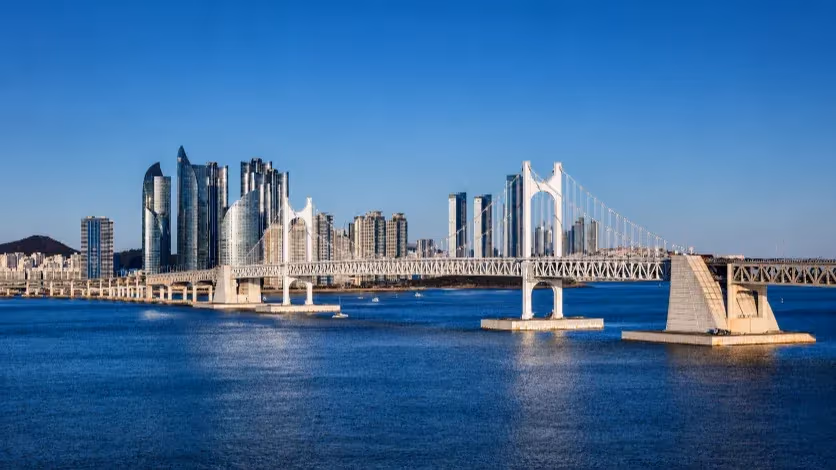
In that vacuum, development itself became the industry. The coastline was recast as the frontier of recovery. In 1996, the city approved a massive reclamation in Haeundae Bay: Marine City. It was promoted as a new marine business district, but behind the branding lay a simple calculation—real estate could succeed where factories had failed. When the 1997 Asian Financial Crisis hit, most investors withdrew, and the project stalled. Construction resumed years later under a revised model that replaced business space with luxury housing. By the time the towers rose, “international marine business” had become a skyline of speculative apartments.
A few kilometers inland, Centum City offered a different vocabulary for the same logic. Built on the site of the old Gimhae Airfield, it was planned as a multimedia and IT hub—a regional answer to Seoul’s digital economy. The ambition was national: to create a “knowledge-based city” beyond the capital. Yet the reality proved cyclical. As financing waned and corporate tenants failed to appear, cultural and retail projects filled the void. BEXCO, the Busan Cinema Center, and the Shinsegae complex gave the district architectural prestige, but not economic depth.
Together, Marine City and Centum City marked Busan’s first coastal turn—from production to presentation. The city traded machinery for marketing, labor for land value. Apartment prices along Suyeong Bay tripled within a decade; population in the inner districts fell just as fast. The urban economy expanded spatially while contracting functionally: more skyline, less substance.
Behind the rhetoric of globalization lay a quieter truth. The logic of reclamation had not changed—it had simply found a new purpose. What once justified itself as industrial progress now advanced as lifestyle urbanism. Construction replaced manufacturing as Busan’s growth engine, and architecture became its economic language.
By the late 2000s, the transformation was complete. The eastern shoreline glittered with towers and convention halls, while the inland core aged into neglect. The contrast was more than visual; it was structural. Busan had built a new image on old habits—a city still solving every problem by adding more land.
The Second Coastal Turn
When Busan’s eastern shoreline glittered with glass towers, the city turned west—toward the wide, flat estuary of the Nakdonggang River. There, where tidal mud met industrial runoff, planners saw a blank slate for another reinvention. In the 2010s, two vast reclamation projects took shape: Myeongji International New City and Eco Delta City (EDC). Both promised to correct the excesses of earlier developments. Both repeated them.
Myeongji began with familiar ambition. Drafted in the mid-2000s, it was marketed as a self-contained international district—green, walkable, transit-oriented. Its master plan blended housing, commerce, and waterfront culture in a single vision of “eco-urbanism.” But execution followed the old script: land first, industry later. Towers rose, schools opened, cafés appeared—but the corporate tenants never did. What was billed as a mixed-use global hub became a commuter suburb, its skyline mirrored in the tidal flats it replaced.
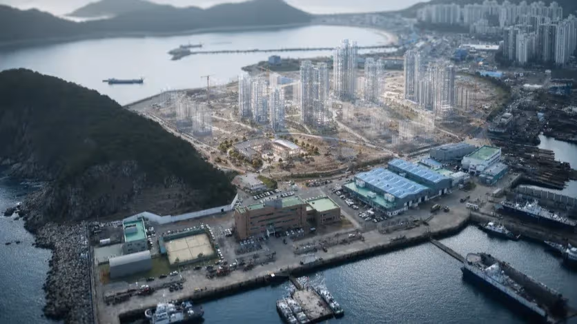
Eco Delta City extended the experiment under a smarter name. Launched in 2019 as Korea’s flagship “smart water city,” it covers twelve million square meters of reclaimed ground along the Nakdonggnag. Jointly managed by K-water and Busan City, the project promised a living laboratory of green tech—autonomous shuttles, flood-adaptive streets, and homes that regulate their own energy. Yet beneath the digital branding lay a familiar balance sheet: most revenue still came from parcel sales, not innovation. The pilot zones of 200 “smart homes” drew national attention but few industries followed.
The westward shift changed Busan’s geography but not its economy. Myeongji and Eco Delta absorbed capital and population, yet produced few stable jobs. They were built as catalysts but function as housing stock. The public–private structure that funds these projects rewards construction over continuity, and “smart” often serves as shorthand for speculative. Busan’s growth machine, refined over a century, had learned to translate engineering into economics—without necessarily producing industry in between.
Around the estuary, new developments radiate the same pattern. Dadaepo’s shoreline redevelopment favors leisure and marinas over manufacturing. Offshore, Gadeok Island hosts the next mega-project: a new international airport and port expansion meant to revive logistics. Together, they extend the city’s map further into the sea while its inland core continues to age and empty.
Busan’s second coastal turn thus marks both progress and repetition. It has mastered the technology of reclamation, but not the strategy of reinvention. The cranes over the Nakdonggang River symbolize ambition without alignment—a city that keeps finding new edges to build, but not new centers to hold.
The Hollow Hills
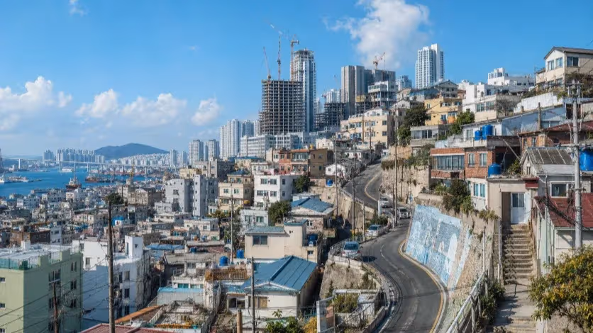
As Busan’s coastline expanded, its interior contracted. The steep districts that once absorbed refugees and workers after the war have become the city’s most visible measure of decline. While cranes reshaped the waterfront, the hills aged in place.
Between 2000 and 2020, population in the four central districts—Seo-gu, Dong-gu, Jung-gu, and Yeongdo-gu—fell by more than 40 percent. In many hillside neighborhoods, two-thirds of residents are now over sixty. Schools have closed, clinics have downsized, and traditional markets operate at a fraction of their former capacity. The physical landscape has outlasted the social one.
Urban regeneration programs offered visibility rather than recovery. The Sanbok-doro Renaissance and later Urban Regeneration New Deal projects delivered murals, viewing platforms, and small tourism grants, but little in the way of sustained population or employment. Cultural branding substituted for social policy. Streets improved, but the demographic curve continued to decline.
Commercial erosion followed the same trajectory. Busanjin-gu and Yeonje-gu, once middle-income commercial centers, now record some of the city’s highest retail vacancy rates. Around Seomyeon and Gaya, markets have fragmented into short-term leases and pop-up stores. In the eastern hills near Pusan National University, falling enrollment has emptied cafés and bookstores. The student and service economies that once anchored the city’s midsection are weakening together.
The pattern is visible in land-value data. Coastal zones such as Haeundae, Suyeong, and Centum have tripled in value since 2000, while inland districts have remained flat. Public and private capital alike have concentrated on the shoreline. The result is a bifurcated city—one defined by speculative construction along the coast and demographic contraction inland.
Urban planning continues to treat the hills as aesthetic rather than economic territory. Projects frame them as heritage landscapes, suitable for preservation or tourism, rather than as housing and employment challenges. Yet the topography that once provided refuge now amplifies isolation. Steep terrain inflates construction costs and deters mobility; fragmented ownership complicates redevelopment. Incremental improvement cannot reverse systemic decline.
The hollowing of the hills encapsulates Busan’s broader imbalance. The city has added millions of square meters of reclaimed land, but cannot fill its existing neighborhoods. Its coastline has modernized faster than its core has survived. Without reintegration of these aging districts into the city’s industrial and demographic base, Busan risks sustaining growth only at its edges—a vertical economy at the water, and a horizontal vacancy in the hills.
The Cost of Reclamation
For more than a century, Busan’s growth strategy has been measured in square meters. From tidal flats and wetlands to the river plains of the Nakdonggang, every frontier of water and land was converted into new ground. Every crisis—colonial expansion, war, industrial decline, financial shock—produced the same response: build new land to build new hope. The result is a city physically enlarged but economically diluted. Engineering has delivered space; policy has failed to fill it.
The pattern persists across eras. The reclaimed zones of the early twentieth century gave Japan its continental gateway; postwar fills provided housing for refugees and factories for recovery; the industrial reclamations of the 1970s sought modernization without autonomy; and the “smart” and “eco” districts of the 2000s pursued innovation without industry. The vocabulary changed, but the dependency remained. Busan’s economy moved from manufacturing to construction, from production to transaction. Growth became an act of repetition.
This structural inertia defines Busan’s paradox. The city is home to Korea’s largest port, yet most of its cargo originates elsewhere. It has world-class convention halls, but few global headquarters. Its skyline expands while its labor market contracts. GDP per capita trails behind other metropolitan regions, even as land values surge. Real estate has become both engine and indicator—a system where investment circulates through land rather than through labor.
The social outcome mirrors the economic one. Along the coast, apartment towers and retail complexes sustain an illusion of progress; inland, demographic collapse accelerates. The workforce that built the city has aged beyond replacement, while younger generations leave for Seoul, Ulsan, or overseas. A city that once absorbed the nation’s displaced population now exports its own. The imbalance between physical and human capital grows sharper each year.
Breaking the cycle requires abandoning the reflex of expansion. The next stage of reclamation cannot be spatial; it must be structural. Busan’s competitiveness will not come from another shoreline, but from a new kind of integration—linking its port economy to advanced logistics, maritime robotics, green shipping, and digital manufacturing; connecting its universities with high-value industries; and aligning urban redevelopment with demographic policy, not real-estate cycles.
Comparative models exist. Yokohama shifted from port decline to creative industry by linking waterfront redevelopment with cultural production. Hamburg integrated its port with renewable energy logistics and digital infrastructure. Even Incheon’s Songdo, despite its flaws, demonstrates how governance and corporate tenancy can anchor new urban economies. Busan’s geography offers equal potential—if its policies can shift from land creation to value creation.
The engineering century is over. Busan no longer needs to conquer the sea; it needs to cultivate what already stands on its shores. The true cost of reclamation is not measured in dredging budgets or square kilometers, but in the opportunity lost each time the city built land instead of capacity. The question now is not whether Busan can expand, but whether it can evolve.
Editorial Context
"Independent journalism relies on radical transparency. View our full log of editorial notes, corrections, and project dispatches in the Newsroom Transparency Log."
Reader Pulse
The report's impact signal
Be the first to provide a reading pulse. These collective signals help our newsroom understand the impact of our reporting.
Join the discussion
A more thoughtful conversation, anchored to the story
Atlantic-style discussion for this article. One-level replies, editor prompts, and moderation-first participation are now powered directly by Prisma.
Discussion Status
Open
Please sign in to join the discussion.
The Weekly Breeze
Independent reporting and analysis on Busan,
Korea, and the broader regional economy.