Busan’s Geography Built Its Past — and May Shape Its Climate Future
Busan’s rugged landscape has shaped its dense, adaptive urban form — now offering insights into climate resilience and terrain-conscious planning.
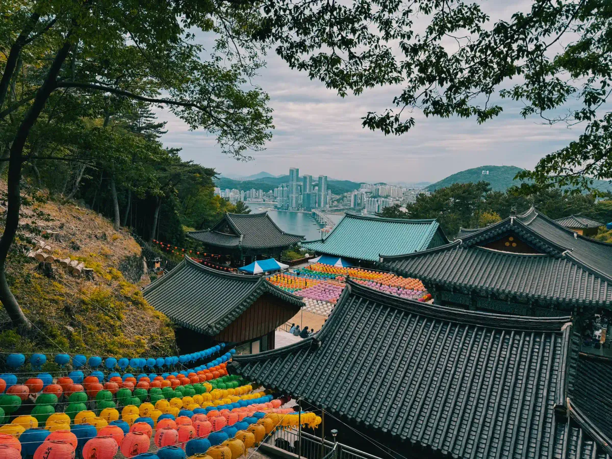
Few cities are as physically entangled with nature as Busan. Step outside almost anywhere in this port city, and within minutes, your path begins to rise — toward a pine-covered ridge, a ridgeline staircase, or a sudden cliff view of the sea. To one side, the ocean unfurls wide and restless. To the other, mountains climb up in steep, forested walls. And between them, rivers weave quietly through the city’s folds, sometimes hidden under roads, sometimes opening into broad estuaries that blur the line between land and water.
Here, geography is not a backdrop — it is the city itself. Busan doesn’t sprawl; it clings, climbs, and spills. Houses stack along slopes like building blocks holding on to the earth. Roads coil around ridges in dizzy switchbacks. Subways tunnel beneath hills while footpaths rise in ancient zigzags toward weather-worn temples. The sea is always just down the hill. The mountain, just up the alley. The river, never far behind.
This is a city shaped — sometimes hemmed in, sometimes liberated — by the land it inhabits. A city where mountain winds reach the markets and harbor fog rolls into neighborhoods. Where life has had to bend around terrain, and where terrain has, in turn, sculpted life.
To understand Busan is to understand how its mountains, rivers, and sea are not merely features — they are forces that built its homes, scattered its communities, defined its economy, and carried its stories. This is the geography of a city not made despite nature, but through it.
A City Folded by Nature — Busan's Geographic Framework
If Seoul is a city that spreads across a basin, Busan is a city wedged into a maze.
Located at the southeastern edge of the Korean Peninsula, Busan is often described by its maritime identity. But the city is, in truth, the product of three natural forces: mountains that press from the north and west, rivers that carve through its heart, and the sea that defines its edge. This triad has dictated not only the shape of the city but the behavior of its people, the structure of its economy, and the limits of its expansion.
Busan’s terrain is steep, uneven, and densely folded. Nearly half of the city’s land area — around 47% — is classified as mountainous. The dominant ridges, including Geumjeongsan, Baegyangsan, and Jangsan mautains, frame the city in natural walls. At the same time, the Nakdonggang River, Korea’s longest, meanders through the western flank of the city, where its delta forms a fragile web of wetlands and reclaimed industrial zones. The eastern boundary, in contrast, meets the open sea — a vast, kinetic presence that has sustained Busan as a shipping hub for over a century.
Urban development in Busan has always been a negotiation with these landforms. With flat ground scarce, homes and infrastructure have long been built vertically, not horizontally. Early settlements hugged hillsides and followed ridgelines. Industrial zones grew not just near the coast, but often on land created by pushing back the sea — an engineering necessity born of geographic pressure.
Geography in Busan is not abstract. It defines where a subway can be built, how a storm drains, where a fire spreads, and how a child walks to school. The steep slopes of Sanbokdoro neighborhoods mean that accessibility, emergency response, and even mail delivery operate differently than in flatter cities. And for city planners, architects, and engineers, every map begins with contour lines.
At times, geography has enabled: the sea connected Busan to Japan and beyond, making it a natural port long before modern infrastructure existed. But more often, it has constrained — blocking the kind of urban sprawl common elsewhere, and forcing the city into narrow vertical corridors or costly tunnels and bridges.
As Busan continues to expand and redefine itself as a global gateway — with floating cities, smart eco-districts, and major port expansions on the horizon — the question remains: how does a city move forward when the land itself resists?
History on the Edge — Busan’s Modern Formation through Geography
From the moment Busan was forcibly opened as a treaty port in 1876, it was not only its harbor but its landforms that made it a target — and a paradox. The city’s deep, natural bay and proximity to Japan offered strategic appeal. But the very terrain that made it defensible also made it difficult to develop. For colonizers, planners, and refugees alike, building Busan meant confronting the stubborn contours of land and water.
During the Japanese colonial period (1910–1945), the terrain was both exploited and reshaped. Hills were cut, shorelines extended. The limited flat land in Nampo and Jung-gu became administrative and commercial centers, while Japanese authorities extended the railway system southward through mountain passes to connect the port to inland resource zones. Colonial housing sprawled carefully along ridges, while local Korean communities were pushed into less accessible, steeper terrain. In many ways, the topography mirrored and enforced the social stratification of occupation.
Then came the war. In 1950, as North Korean troops swept southward, Busan became the last bastion of the Republic of Korea, and soon, the wartime capital. Over a million refugees poured into a city ill-equipped to absorb them. With no space to expand outward, people built upward — clinging to hillsides in makeshift homes, hammering tin roofs into the mountains. These settlements — from Ami-dong to Gamcheon — would become some of the most iconic features of the cityscape.
Infrastructure did not follow evenly. Streets narrowed into staircases. Electricity came late, plumbing later. But what emerged was an improvised urbanism, born from necessity but infused with resilience. In a matter of years, Busan’s jagged geography had absorbed a human catastrophe and transformed it into a permanent landscape of survival.
By the late 20th century, this hillside density would become a planning challenge — but also a cultural asset. The very inaccessibility that once marked these neighborhoods for neglect later helped preserve their character. And now, as global cities search for authenticity, Busan’s history of improvising with its terrain has become a central part of its identity.
Busan did not spread out like Seoul. It climbed. It burrowed. It grew where it could, and only when the land gave way.
Living on a Slope — The Social Topography of Busan
In Busan, geography doesn’t just shape the city’s skyline — it shapes social life.
The hillside settlements that once offered last-resort shelter to refugees have evolved into neighborhoods layered with memory, improvisation, and inequality. In cities with more forgiving topography, urban planning often reflects hierarchy in familiar ways: suburbs for the affluent, inner-city blocks for workers. In Busan, the height of your home once reflected the precarity of your life — the higher you climbed, the farther you were from water, roads, and services.
Neighborhoods like Gamcheon, Ami-dong, and Sanbokdoro formed out of this vertical desperation. Built hastily and often illegally on steep mountain flanks, they lacked infrastructure, sanitation, and even formal addresses for decades. Residents laid their own pipes, carried groceries up hundreds of steps, and watched emergency vehicles stop far below. In these places, a fire or medical emergency wasn’t just a crisis — it was a race against gravity.
Today, many of these communities still struggle with marginalization. Steep grades limit access for the elderly, property rights remain murky due to decades of informal building, and public investment has often been uneven. Yet at the same time, these areas have become symbols of resilience and cultural richness — so much so that urban regeneration projects now market their irregular alleys and pastel rooftops as tourist assets.
Projects like the Sanbokdoro Renaissance and Gamcheon Culture Village sought to stabilize and beautify these neighborhoods without erasing their character. But gentrification pressure followed. Rising rents, tourism fatigue, and displacement now haunt areas once defined by exclusion. Aesthetic value — long overlooked — has become a currency, and the very slopes that once signified poverty are now priced for their view.
Busan’s social geography remains stratified — not just economically, but topographically. The city’s wealthier areas — Marine City, Centum, Haeundae New Town — rise from reclaimed flatlands, engineered and leveled for sleek towers and malls. Meanwhile, many working-class families still live uphill, literally and figuratively. In this city, elevation remains a legacy — one tied not to privilege, but to survival.
At the same time, grassroots activism and community design movements have emerged from the hills. Local residents have reasserted control of neighborhood plans, launched co-ops, and preserved oral histories embedded in these tangled alleys. In Busan, urban inequality is written in slope and stair, but so is the story of collective adaptation.
Designing with Terrain — Urban Planning and Busan’s Search for Space
For most cities, urban planning begins with land. For Busan, it begins with what’s left of it.
Cramped between steep mountains and an encroaching sea, Busan has long faced a fundamental constraint: where to build. Flat, developable land is scarce, and what little there is has often been claimed by industry, port facilities, or early urban cores. The result is a city that has had to engineer, tunnel, reclaim, and layer itself to grow.
One of Busan’s key strategies has been land reclamation. The massive Centum City business district and parts of Haeundae were built on land wrested from the Suyeong River estuary and surrounding wetlands. The Busan New Port, located 40 kilometers west of the city center, sits on entirely reclaimed coastal land. These projects offered the clean-slate urbanism that Busan’s inner core could not — flat, open, and efficient.
But expansion has also pushed upward. The city’s dense topography has forced planners to embrace three-dimensional urbanism: terraced housing, multi-level pedestrian networks, cable cars, and hillside elevators (like those in Yeongdo and Sanbokdoro) have become part of the planning vocabulary. Public housing programs and redevelopment efforts have often targeted these older hillside districts, aiming to upgrade living conditions without flattening their form.
Yet challenges remain. Slope instability, flooding, and limited vehicle access make hillside neighborhoods both vulnerable and expensive to modernize. Meanwhile, efforts to flatten more terrain — by cutting into hills or expanding into the sea — have drawn criticism from environmental groups concerned about long-term sustainability and climate risk.
Busan’s response has been twofold: build outward with innovation, and build inward with care.
The Eco Delta City project, located near the Nakdong River delta, is perhaps the most ambitious example of outward innovation. Billed as a “smart waterfront city,” it incorporates AI-driven energy systems, water recycling, and flood-resistant design — all while being constructed on previously flood-prone land. Similarly, Busan’s selection as host city for Oceanix, the world’s first floating city prototype, reflects its attempt to redefine urban geography itself in the face of rising seas.
On the other end, planners are also looking inward, investing in micro-level urban repair. Programs like the Sanbokdoro Renaissance Project seek to preserve and upgrade aging hillside settlements rather than replace them — emphasizing walkability, cultural heritage, and community-driven design. Busan has begun implementing topographic-sensitive zoning, acknowledging that a flat city model doesn’t fit here.
There’s also a deeper shift underway: a growing recognition that Busan’s topographic identity is an asset, not a hindrance. Urban designers and architects increasingly reference the city’s natural contours in their work, not as barriers, but as frameworks. This is evident in transit-oriented developments that contour to valleys, in parks that flow along ridgelines, and in heritage planning that treats slope-side neighborhoods as cultural archives.
Still, the city walks a tightrope. Gentrification threatens the authenticity of regenerated areas, and mega-projects like Eco Delta risk becoming enclaves of elite futurism unless they connect meaningfully to the city’s broader fabric. The biggest challenge may not be where Busan grows, but who gets to grow with it.
The Next Ascent — Busan’s Geography as a Future Blueprint
Busan has never had the luxury of easy growth. Its neighborhoods were not laid out on broad grids, but on switchbacks and stairways. Its industries did not sprawl; they were stacked, tunneled, reclaimed, or squeezed into the tight margins between mountain and sea. The city’s geography forced it to adapt — and in doing so, Busan became a kind of laboratory for terrain-based urban survival.
Now, in the era of climate uncertainty, that hard-earned adaptability may prove to be one of its greatest assets.
As sea levels rise and weather patterns become more extreme, many global cities will confront the same questions Busan has lived with for decades: How do you build a city when space is fragmented? How do you protect a dense, vertical population from flood and landslide? How do you preserve human-scale neighborhoods in places where conventional infrastructure won’t reach?
Busan, simply by necessity, has been answering these questions — imperfectly but persistently. The city’s efforts to retrofit aging hillside communities with small-scale elevators and cable lifts may seem modest, but in a future where slope-side living becomes more common due to climate displacement, these could be vital templates. Likewise, its experimentation with floating infrastructure, greenbelt preservation, and estuary-based smart cities marks a new frontier in geography-aware planning.
But vision alone will not be enough. For Busan’s next chapter to succeed, it must honor the complexity of its past. Innovation must not erase the places where history is written in alleyways and rooftops. Climate resilience must mean more than technological novelty — it must also mean social resilience: affordable housing on the slopes, equitable transit to the peaks, and development that lifts long-neglected communities along with the skyline.
More than a city of steel and sea, Busan is a city of thresholds — where land meets water, where past meets future, and where every ascent reveals a new vantage. Its geography has long shaped the lives of its people. In the coming decades, how it shapes its response to the planet’s challenges may define far more.
In Busan, the climb has never been easy. But it’s always led somewhere.


Comments ()